You are here: Home > Network List > G - GEOSCOPE Stations List
> Station MPG Montagne des Peres, French Guyana > Earthquake Result Viewer
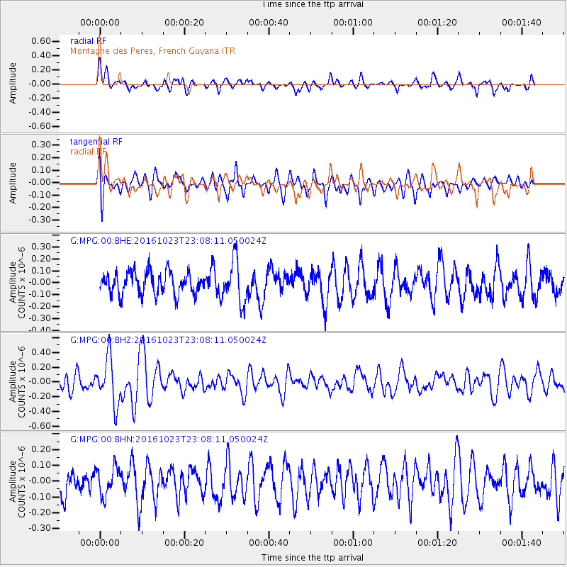
MPG Montagne des Peres, French Guyana - Earthquake Result Viewer
*The percent match for this event was below the threshold and hence no stack was calculated.
| Earthquake location: |
Near Coast Of Jalisco, Mexico |
| Earthquake latitude/longitude: |
18.9/-104.6 |
| Earthquake time(UTC): |
2016/10/23 (297) 22:59:29 GMT |
| Earthquake Depth: |
12 km |
| Earthquake Magnitude: |
5.6 MWW, 5.4 MWB |
| Earthquake Catalog/Contributor: |
NEIC PDE/NEIC COMCAT |
|
| Network: |
G GEOSCOPE |
| Station: |
MPG Montagne des Peres, French Guyana |
| Lat/Lon: |
5.11 N/52.64 W |
| Elevation: |
147 m |
|
| Distance: |
52.4 deg |
| Az: |
98.287 deg |
| Baz: |
289.872 deg |
| Ray Param: |
$rayparam |
*The percent match for this event was below the threshold and hence was not used in the summary stack. |
|
| Radial Match: |
65.42939 % |
| Radial Bump: |
400 |
| Transverse Match: |
57.95143 % |
| Transverse Bump: |
400 |
| SOD ConfigId: |
1858631 |
| Insert Time: |
2016-12-01 04:53:50.091 +0000 |
| GWidth: |
2.5 |
| Max Bumps: |
400 |
| Tol: |
0.001 |
|
Signal To Noise
| Channel | StoN | STA | LTA |
| G:MPG:00:BHZ:20161023T23:08:11.050024Z | 2.8625185 | 3.265467E-7 | 1.1407672E-7 |
| G:MPG:00:BHN:20161023T23:08:11.050024Z | 0.862062 | 9.1187744E-8 | 1.0577864E-7 |
| G:MPG:00:BHE:20161023T23:08:11.050024Z | 1.9348027 | 1.8014703E-7 | 9.310873E-8 |
| Arrivals |
| Ps | |
| PpPs | |
| PsPs/PpSs | |


