You are here: Home > Network List > TA - USArray Transportable Network (new EarthScope stations) Stations List
> Station 127A Arkansas Junction, Hobbs, NM, USA > Earthquake Result Viewer
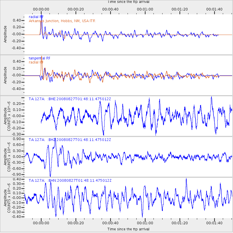
127A Arkansas Junction, Hobbs, NM, USA - Earthquake Result Viewer
*The percent match for this event was below the threshold and hence no stack was calculated.
| Earthquake location: |
Lake Baykal Region, Russia |
| Earthquake latitude/longitude: |
51.6/104.2 |
| Earthquake time(UTC): |
2008/08/27 (240) 01:35:32 GMT |
| Earthquake Depth: |
16 km |
| Earthquake Magnitude: |
5.8 MB, 6.2 MS, 6.2 MW, 6.2 MW |
| Earthquake Catalog/Contributor: |
WHDF/NEIC |
|
| Network: |
TA USArray Transportable Network (new EarthScope stations) |
| Station: |
127A Arkansas Junction, Hobbs, NM, USA |
| Lat/Lon: |
32.68 N/103.36 W |
| Elevation: |
1160 m |
|
| Distance: |
92.7 deg |
| Az: |
22.958 deg |
| Baz: |
343.237 deg |
| Ray Param: |
$rayparam |
*The percent match for this event was below the threshold and hence was not used in the summary stack. |
|
| Radial Match: |
76.23435 % |
| Radial Bump: |
400 |
| Transverse Match: |
73.06486 % |
| Transverse Bump: |
400 |
| SOD ConfigId: |
2658 |
| Insert Time: |
2010-03-06 23:36:42.138 +0000 |
| GWidth: |
2.5 |
| Max Bumps: |
400 |
| Tol: |
0.001 |
|
Signal To Noise
| Channel | StoN | STA | LTA |
| TA:127A: :BHZ:20080827T01:48:11.475012Z | 3.717418 | 3.1832997E-7 | 8.563201E-8 |
| TA:127A: :BHN:20080827T01:48:11.475012Z | 2.6331415 | 1.3611867E-7 | 5.1694407E-8 |
| TA:127A: :BHE:20080827T01:48:11.475012Z | 1.2887052 | 1.0665354E-7 | 8.276023E-8 |
| Arrivals |
| Ps | |
| PpPs | |
| PsPs/PpSs | |


