You are here: Home > Network List > CN - Canadian National Seismograph Network Stations List
> Station INK INUVIK, NT > Earthquake Result Viewer
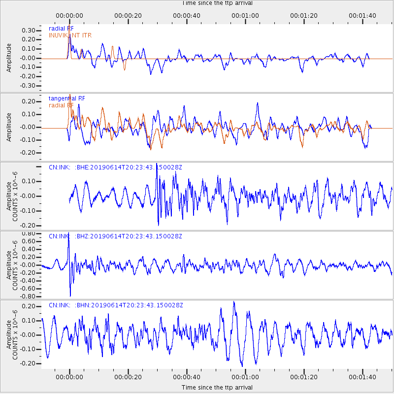
INK INUVIK, NT - Earthquake Result Viewer
*The percent match for this event was below the threshold and hence no stack was calculated.
| Earthquake location: |
Banda Sea |
| Earthquake latitude/longitude: |
-5.9/130.7 |
| Earthquake time(UTC): |
2019/06/14 (165) 20:10:52 GMT |
| Earthquake Depth: |
104 km |
| Earthquake Magnitude: |
5.6 Mww |
| Earthquake Catalog/Contributor: |
NEIC PDE/us |
|
| Network: |
CN Canadian National Seismograph Network |
| Station: |
INK INUVIK, NT |
| Lat/Lon: |
68.31 N/133.53 W |
| Elevation: |
44 m |
|
| Distance: |
97.5 deg |
| Az: |
21.91 deg |
| Baz: |
273.175 deg |
| Ray Param: |
$rayparam |
*The percent match for this event was below the threshold and hence was not used in the summary stack. |
|
| Radial Match: |
62.983063 % |
| Radial Bump: |
400 |
| Transverse Match: |
56.89771 % |
| Transverse Bump: |
400 |
| SOD ConfigId: |
18369291 |
| Insert Time: |
2019-06-28 20:12:18.296 +0000 |
| GWidth: |
2.5 |
| Max Bumps: |
400 |
| Tol: |
0.001 |
|
Signal To Noise
| Channel | StoN | STA | LTA |
| CN:INK: :BHZ:20190614T20:23:43.150028Z | 5.795891 | 3.0167135E-7 | 5.2049174E-8 |
| CN:INK: :BHN:20190614T20:23:43.150028Z | 0.9193713 | 6.124898E-8 | 6.66205E-8 |
| CN:INK: :BHE:20190614T20:23:43.150028Z | 2.2950559 | 1.01041486E-7 | 4.4025718E-8 |
| Arrivals |
| Ps | |
| PpPs | |
| PsPs/PpSs | |


