You are here: Home > Network List > TA - USArray Transportable Network (new EarthScope stations) Stations List
> Station B18K Kokolik River, AK, USA > Earthquake Result Viewer
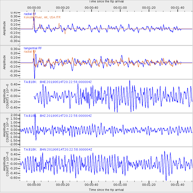
B18K Kokolik River, AK, USA - Earthquake Result Viewer
*The percent match for this event was below the threshold and hence no stack was calculated.
| Earthquake location: |
Banda Sea |
| Earthquake latitude/longitude: |
-5.9/130.7 |
| Earthquake time(UTC): |
2019/06/14 (165) 20:10:52 GMT |
| Earthquake Depth: |
104 km |
| Earthquake Magnitude: |
5.6 Mww |
| Earthquake Catalog/Contributor: |
NEIC PDE/us |
|
| Network: |
TA USArray Transportable Network (new EarthScope stations) |
| Station: |
B18K Kokolik River, AK, USA |
| Lat/Lon: |
69.36 N/161.80 W |
| Elevation: |
222 m |
|
| Distance: |
87.7 deg |
| Az: |
19.131 deg |
| Baz: |
246.886 deg |
| Ray Param: |
$rayparam |
*The percent match for this event was below the threshold and hence was not used in the summary stack. |
|
| Radial Match: |
61.532803 % |
| Radial Bump: |
400 |
| Transverse Match: |
74.76323 % |
| Transverse Bump: |
400 |
| SOD ConfigId: |
18369291 |
| Insert Time: |
2019-06-28 20:13:36.738 +0000 |
| GWidth: |
2.5 |
| Max Bumps: |
400 |
| Tol: |
0.001 |
|
Signal To Noise
| Channel | StoN | STA | LTA |
| TA:B18K: :BHZ:20190614T20:22:58.000004Z | 4.667598 | 7.059553E-7 | 1.5124594E-7 |
| TA:B18K: :BHN:20190614T20:22:58.000004Z | 1.7334734 | 1.9873582E-7 | 1.14646014E-7 |
| TA:B18K: :BHE:20190614T20:22:58.000004Z | 1.3939233 | 1.9575329E-7 | 1.4043333E-7 |
| Arrivals |
| Ps | |
| PpPs | |
| PsPs/PpSs | |


