You are here: Home > Network List > TA - USArray Transportable Network (new EarthScope stations) Stations List
> Station C16K Lisburne Hills, AK, USA > Earthquake Result Viewer
C16K Lisburne Hills, AK, USA - Earthquake Result Viewer
*The percent match for this event was below the threshold and hence no stack was calculated.
| Earthquake location: |
Banda Sea |
| Earthquake latitude/longitude: |
-5.9/130.7 |
| Earthquake time(UTC): |
2019/06/14 (165) 20:10:52 GMT |
| Earthquake Depth: |
104 km |
| Earthquake Magnitude: |
5.6 Mww |
| Earthquake Catalog/Contributor: |
NEIC PDE/us |
|
| Network: |
TA USArray Transportable Network (new EarthScope stations) |
| Station: |
C16K Lisburne Hills, AK, USA |
| Lat/Lon: |
68.27 N/165.34 W |
| Elevation: |
102 m |
|
| Distance: |
86.1 deg |
| Az: |
19.587 deg |
| Baz: |
243.611 deg |
| Ray Param: |
$rayparam |
*The percent match for this event was below the threshold and hence was not used in the summary stack. |
|
| Radial Match: |
59.751774 % |
| Radial Bump: |
400 |
| Transverse Match: |
56.17598 % |
| Transverse Bump: |
400 |
| SOD ConfigId: |
18369291 |
| Insert Time: |
2019-06-28 20:13:39.910 +0000 |
| GWidth: |
2.5 |
| Max Bumps: |
400 |
| Tol: |
0.001 |
|
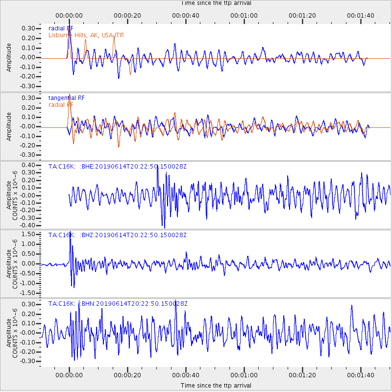
Signal To Noise
| Channel | StoN | STA | LTA |
| TA:C16K: :BHZ:20190614T20:22:50.150028Z | 6.7202907 | 5.5631864E-7 | 8.278193E-8 |
| TA:C16K: :BHN:20190614T20:22:50.150028Z | 2.0914729 | 1.5597982E-7 | 7.4578935E-8 |
| TA:C16K: :BHE:20190614T20:22:50.150028Z | 2.6785693 | 2.0213844E-7 | 7.5465074E-8 |
| Arrivals |
| Ps | |
| PpPs | |
| PsPs/PpSs | |


