You are here: Home > Network List > TA - USArray Transportable Network (new EarthScope stations) Stations List
> Station I23K Minto, Yukon-Koyukuk, AK, USA > Earthquake Result Viewer
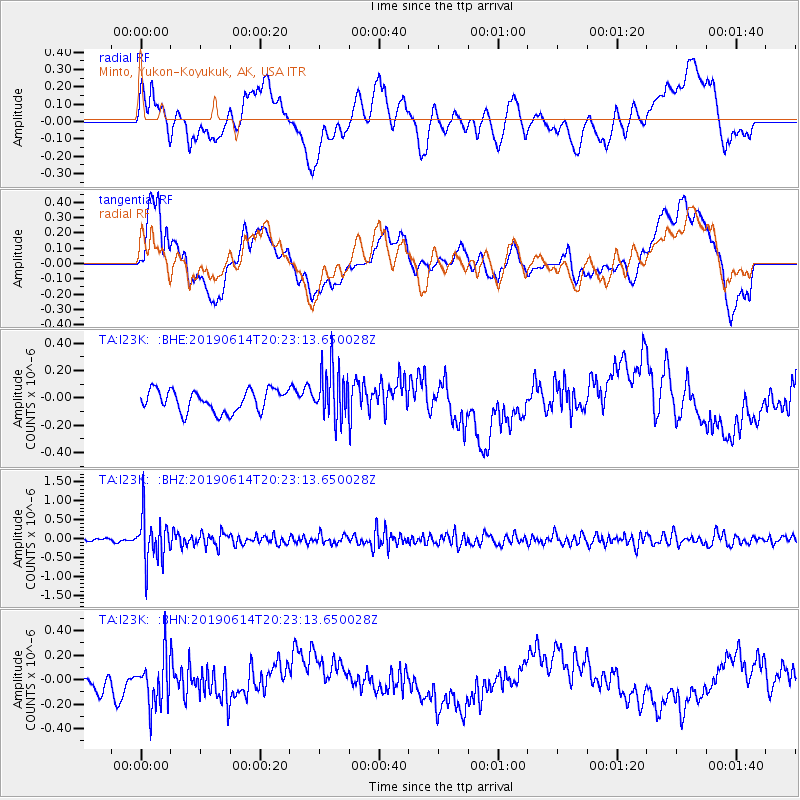
I23K Minto, Yukon-Koyukuk, AK, USA - Earthquake Result Viewer
*The percent match for this event was below the threshold and hence no stack was calculated.
| Earthquake location: |
Banda Sea |
| Earthquake latitude/longitude: |
-5.9/130.7 |
| Earthquake time(UTC): |
2019/06/14 (165) 20:10:52 GMT |
| Earthquake Depth: |
104 km |
| Earthquake Magnitude: |
5.6 Mww |
| Earthquake Catalog/Contributor: |
NEIC PDE/us |
|
| Network: |
TA USArray Transportable Network (new EarthScope stations) |
| Station: |
I23K Minto, Yukon-Koyukuk, AK, USA |
| Lat/Lon: |
65.15 N/149.36 W |
| Elevation: |
149 m |
|
| Distance: |
91.0 deg |
| Az: |
24.592 deg |
| Baz: |
258.423 deg |
| Ray Param: |
$rayparam |
*The percent match for this event was below the threshold and hence was not used in the summary stack. |
|
| Radial Match: |
35.281048 % |
| Radial Bump: |
400 |
| Transverse Match: |
29.373302 % |
| Transverse Bump: |
400 |
| SOD ConfigId: |
18369291 |
| Insert Time: |
2019-06-28 20:14:21.222 +0000 |
| GWidth: |
2.5 |
| Max Bumps: |
400 |
| Tol: |
0.001 |
|
Signal To Noise
| Channel | StoN | STA | LTA |
| TA:I23K: :BHZ:20190614T20:23:13.650028Z | 10.527765 | 5.980835E-7 | 5.6810112E-8 |
| TA:I23K: :BHN:20190614T20:23:13.650028Z | 1.9137887 | 2.020046E-7 | 1.055522E-7 |
| TA:I23K: :BHE:20190614T20:23:13.650028Z | 2.3998845 | 1.905646E-7 | 7.940574E-8 |
| Arrivals |
| Ps | |
| PpPs | |
| PsPs/PpSs | |


