You are here: Home > Network List > GS - US Geological Survey Networks Stations List
> Station KAN10 Keim Farm > Earthquake Result Viewer
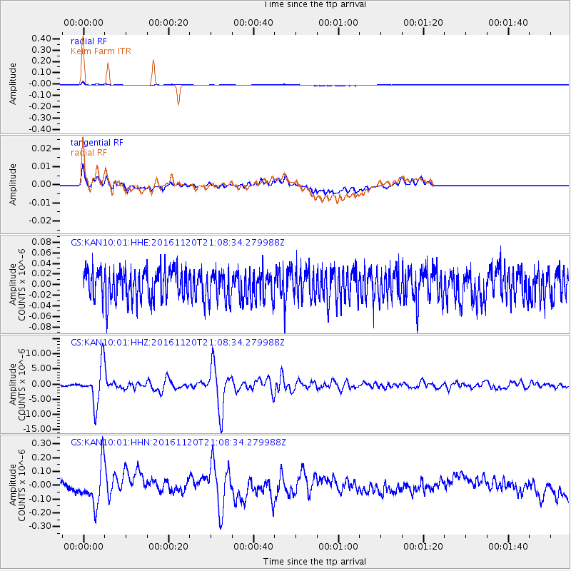
KAN10 Keim Farm - Earthquake Result Viewer
*The percent match for this event was below the threshold and hence no stack was calculated.
| Earthquake location: |
San Juan Province, Argentina |
| Earthquake latitude/longitude: |
-31.6/-68.8 |
| Earthquake time(UTC): |
2016/11/20 (325) 20:57:43 GMT |
| Earthquake Depth: |
116 km |
| Earthquake Magnitude: |
6.4 MWP, 6.5 MWB |
| Earthquake Catalog/Contributor: |
NEIC PDE/NEIC COMCAT |
|
| Network: |
GS US Geological Survey Networks |
| Station: |
KAN10 Keim Farm |
| Lat/Lon: |
37.12 N/98.10 W |
| Elevation: |
417 m |
|
| Distance: |
73.7 deg |
| Az: |
335.926 deg |
| Baz: |
154.197 deg |
| Ray Param: |
$rayparam |
*The percent match for this event was below the threshold and hence was not used in the summary stack. |
|
| Radial Match: |
73.57223 % |
| Radial Bump: |
400 |
| Transverse Match: |
66.045845 % |
| Transverse Bump: |
400 |
| SOD ConfigId: |
1858631 |
| Insert Time: |
2016-12-04 21:00:46.041 +0000 |
| GWidth: |
2.5 |
| Max Bumps: |
400 |
| Tol: |
0.001 |
|
Signal To Noise
| Channel | StoN | STA | LTA |
| GS:KAN10:01:HHZ:20161120T21:08:34.279988Z | 32.593296 | 6.3868774E-6 | 1.9595679E-7 |
| GS:KAN10:01:HHN:20161120T21:08:34.279988Z | 5.363929 | 1.4248084E-7 | 2.6562777E-8 |
| GS:KAN10:01:HHE:20161120T21:08:34.279988Z | 0.9713022 | 2.6907534E-8 | 2.7702535E-8 |
| Arrivals |
| Ps | |
| PpPs | |
| PsPs/PpSs | |


