You are here: Home > Network List > AV - Alaska Volcano Observatory Stations List
> Station SPCR Ckakachatna River, Mount Spurr, Alaska > Earthquake Result Viewer
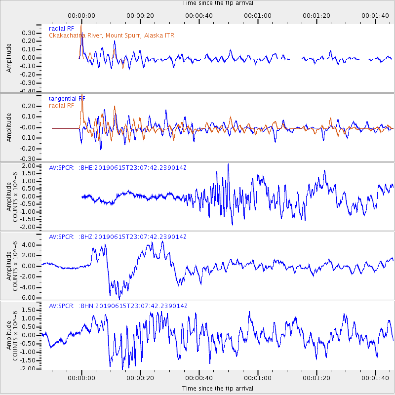
SPCR Ckakachatna River, Mount Spurr, Alaska - Earthquake Result Viewer
*The percent match for this event was below the threshold and hence no stack was calculated.
| Earthquake location: |
Kermadec Islands Region |
| Earthquake latitude/longitude: |
-31.0/-177.4 |
| Earthquake time(UTC): |
2019/06/15 (166) 22:54:55 GMT |
| Earthquake Depth: |
10 km |
| Earthquake Magnitude: |
7.4 Mi |
| Earthquake Catalog/Contributor: |
NEIC PDE/pt |
|
| Network: |
AV Alaska Volcano Observatory |
| Station: |
SPCR Ckakachatna River, Mount Spurr, Alaska |
| Lat/Lon: |
61.20 N/152.21 W |
| Elevation: |
984 m |
|
| Distance: |
94.2 deg |
| Az: |
11.932 deg |
| Baz: |
201.5 deg |
| Ray Param: |
$rayparam |
*The percent match for this event was below the threshold and hence was not used in the summary stack. |
|
| Radial Match: |
76.893196 % |
| Radial Bump: |
400 |
| Transverse Match: |
87.174995 % |
| Transverse Bump: |
400 |
| SOD ConfigId: |
18369291 |
| Insert Time: |
2019-06-29 22:56:30.979 +0000 |
| GWidth: |
2.5 |
| Max Bumps: |
400 |
| Tol: |
0.001 |
|
Signal To Noise
| Channel | StoN | STA | LTA |
| AV:SPCR: :BHZ:20190615T23:07:42.239014Z | 4.1227813 | 1.5831738E-6 | 3.8400628E-7 |
| AV:SPCR: :BHN:20190615T23:07:42.239014Z | 1.806298 | 7.270035E-7 | 4.0248258E-7 |
| AV:SPCR: :BHE:20190615T23:07:42.239014Z | 0.7453812 | 1.5798447E-7 | 2.1195126E-7 |
| Arrivals |
| Ps | |
| PpPs | |
| PsPs/PpSs | |


