You are here: Home > Network List > NE - New England Seismic Network Stations List
> Station EMMW Machias, ME, USA > Earthquake Result Viewer
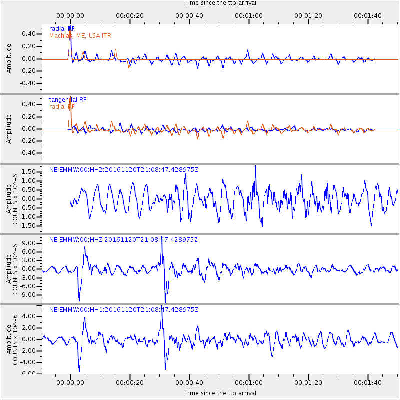
EMMW Machias, ME, USA - Earthquake Result Viewer
*The percent match for this event was below the threshold and hence no stack was calculated.
| Earthquake location: |
San Juan Province, Argentina |
| Earthquake latitude/longitude: |
-31.6/-68.8 |
| Earthquake time(UTC): |
2016/11/20 (325) 20:57:43 GMT |
| Earthquake Depth: |
116 km |
| Earthquake Magnitude: |
6.4 MWP, 6.5 MWB |
| Earthquake Catalog/Contributor: |
NEIC PDE/NEIC COMCAT |
|
| Network: |
NE New England Seismic Network |
| Station: |
EMMW Machias, ME, USA |
| Lat/Lon: |
44.71 N/67.46 W |
| Elevation: |
35 m |
|
| Distance: |
76.0 deg |
| Az: |
0.961 deg |
| Baz: |
181.149 deg |
| Ray Param: |
$rayparam |
*The percent match for this event was below the threshold and hence was not used in the summary stack. |
|
| Radial Match: |
78.59423 % |
| Radial Bump: |
373 |
| Transverse Match: |
55.551987 % |
| Transverse Bump: |
400 |
| SOD ConfigId: |
1858631 |
| Insert Time: |
2016-12-04 21:03:00.349 +0000 |
| GWidth: |
2.5 |
| Max Bumps: |
400 |
| Tol: |
0.001 |
|
Signal To Noise
| Channel | StoN | STA | LTA |
| NE:EMMW:00:HHZ:20161120T21:08:47.428975Z | 8.007604 | 4.070363E-6 | 5.083122E-7 |
| NE:EMMW:00:HH1:20161120T21:08:47.428975Z | 3.5020304 | 2.1012136E-6 | 5.9999866E-7 |
| NE:EMMW:00:HH2:20161120T21:08:47.428975Z | 0.47727135 | 2.4547006E-7 | 5.143197E-7 |
| Arrivals |
| Ps | |
| PpPs | |
| PsPs/PpSs | |


