You are here: Home > Network List > TA - USArray Transportable Network (new EarthScope stations) Stations List
> Station G16K Koyuk River, AK, USA > Earthquake Result Viewer
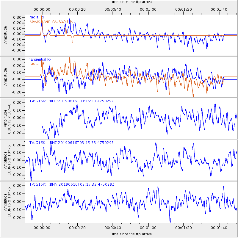
G16K Koyuk River, AK, USA - Earthquake Result Viewer
*The percent match for this event was below the threshold and hence no stack was calculated.
| Earthquake location: |
Kermadec Islands, New Zealand |
| Earthquake latitude/longitude: |
-30.7/-178.0 |
| Earthquake time(UTC): |
2019/06/16 (167) 03:02:38 GMT |
| Earthquake Depth: |
33 km |
| Earthquake Magnitude: |
5.5 mb |
| Earthquake Catalog/Contributor: |
NEIC PDE/us |
|
| Network: |
TA USArray Transportable Network (new EarthScope stations) |
| Station: |
G16K Koyuk River, AK, USA |
| Lat/Lon: |
65.39 N/162.35 W |
| Elevation: |
169 m |
|
| Distance: |
96.6 deg |
| Az: |
6.513 deg |
| Baz: |
193.49 deg |
| Ray Param: |
$rayparam |
*The percent match for this event was below the threshold and hence was not used in the summary stack. |
|
| Radial Match: |
55.286716 % |
| Radial Bump: |
400 |
| Transverse Match: |
48.629326 % |
| Transverse Bump: |
400 |
| SOD ConfigId: |
18369291 |
| Insert Time: |
2019-06-30 03:06:23.386 +0000 |
| GWidth: |
2.5 |
| Max Bumps: |
400 |
| Tol: |
0.001 |
|
Signal To Noise
| Channel | StoN | STA | LTA |
| TA:G16K: :BHZ:20190616T03:15:33.475029Z | 1.0495831 | 8.726509E-8 | 8.314263E-8 |
| TA:G16K: :BHN:20190616T03:15:33.475029Z | 0.9014562 | 7.905767E-8 | 8.769996E-8 |
| TA:G16K: :BHE:20190616T03:15:33.475029Z | 0.6762046 | 7.887087E-8 | 1.1663757E-7 |
| Arrivals |
| Ps | |
| PpPs | |
| PsPs/PpSs | |


