You are here: Home > Network List > AV - Alaska Volcano Observatory Stations List
> Station SPCR Ckakachatna River, Mount Spurr, Alaska > Earthquake Result Viewer
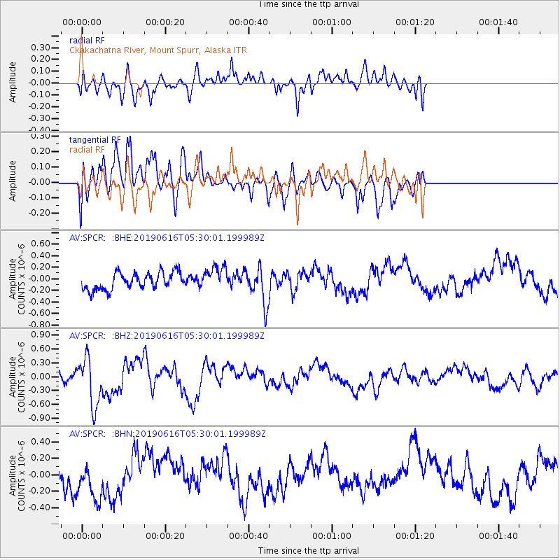
SPCR Ckakachatna River, Mount Spurr, Alaska - Earthquake Result Viewer
*The percent match for this event was below the threshold and hence no stack was calculated.
| Earthquake location: |
Kermadec Islands Region |
| Earthquake latitude/longitude: |
-31.1/-178.0 |
| Earthquake time(UTC): |
2019/06/16 (167) 05:17:16 GMT |
| Earthquake Depth: |
35 km |
| Earthquake Magnitude: |
6.3 Mww |
| Earthquake Catalog/Contributor: |
NEIC PDE/us |
|
| Network: |
AV Alaska Volcano Observatory |
| Station: |
SPCR Ckakachatna River, Mount Spurr, Alaska |
| Lat/Lon: |
61.20 N/152.21 W |
| Elevation: |
984 m |
|
| Distance: |
94.3 deg |
| Az: |
12.208 deg |
| Baz: |
202.008 deg |
| Ray Param: |
$rayparam |
*The percent match for this event was below the threshold and hence was not used in the summary stack. |
|
| Radial Match: |
52.59394 % |
| Radial Bump: |
400 |
| Transverse Match: |
55.143574 % |
| Transverse Bump: |
400 |
| SOD ConfigId: |
18369291 |
| Insert Time: |
2019-06-30 05:23:18.301 +0000 |
| GWidth: |
2.5 |
| Max Bumps: |
400 |
| Tol: |
0.001 |
|
Signal To Noise
| Channel | StoN | STA | LTA |
| AV:SPCR: :BHZ:20190616T05:30:01.199989Z | 3.9256601 | 5.430572E-7 | 1.3833524E-7 |
| AV:SPCR: :BHN:20190616T05:30:01.199989Z | 1.1109678 | 2.3351404E-7 | 2.1018975E-7 |
| AV:SPCR: :BHE:20190616T05:30:01.199989Z | 1.4198197 | 2.0755414E-7 | 1.4618345E-7 |
| Arrivals |
| Ps | |
| PpPs | |
| PsPs/PpSs | |


