You are here: Home > Network List > TA - USArray Transportable Network (new EarthScope stations) Stations List
> Station A21A Bergtoll Ranch, Theony, MT, USA > Earthquake Result Viewer
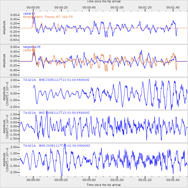
A21A Bergtoll Ranch, Theony, MT, USA - Earthquake Result Viewer
*The percent match for this event was below the threshold and hence no stack was calculated.
| Earthquake location: |
Arctic Ocean |
| Earthquake latitude/longitude: |
79.6/-116.1 |
| Earthquake time(UTC): |
2008/11/17 (322) 12:55:22 GMT |
| Earthquake Depth: |
7.0 km |
| Earthquake Magnitude: |
5.7 MW, 5.2 MS, 5.4 MB, 5.7 MW |
| Earthquake Catalog/Contributor: |
WHDF/NEIC |
|
| Network: |
TA USArray Transportable Network (new EarthScope stations) |
| Station: |
A21A Bergtoll Ranch, Theony, MT, USA |
| Lat/Lon: |
48.99 N/106.93 W |
| Elevation: |
779 m |
|
| Distance: |
30.9 deg |
| Az: |
168.273 deg |
| Baz: |
356.801 deg |
| Ray Param: |
$rayparam |
*The percent match for this event was below the threshold and hence was not used in the summary stack. |
|
| Radial Match: |
60.260468 % |
| Radial Bump: |
400 |
| Transverse Match: |
61.742893 % |
| Transverse Bump: |
351 |
| SOD ConfigId: |
2658 |
| Insert Time: |
2010-03-06 23:50:49.002 +0000 |
| GWidth: |
2.5 |
| Max Bumps: |
400 |
| Tol: |
0.001 |
|
Signal To Noise
| Channel | StoN | STA | LTA |
| TA:A21A: :BHZ:20081117T13:01:09.649009Z | 2.6027572 | 7.499213E-7 | 2.8812573E-7 |
| TA:A21A: :BHN:20081117T13:01:09.649009Z | 1.8363706 | 9.704831E-7 | 5.2847895E-7 |
| TA:A21A: :BHE:20081117T13:01:09.649009Z | 0.61086315 | 3.3508874E-7 | 5.485496E-7 |
| Arrivals |
| Ps | |
| PpPs | |
| PsPs/PpSs | |


