You are here: Home > Network List > TA - USArray Transportable Network (new EarthScope stations) Stations List
> Station A21A Bergtoll Ranch, Theony, MT, USA > Earthquake Result Viewer
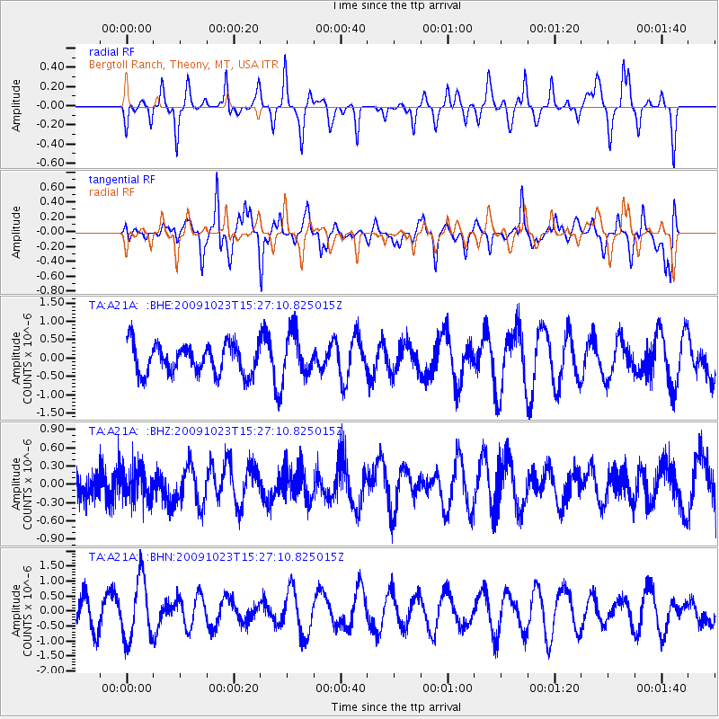
A21A Bergtoll Ranch, Theony, MT, USA - Earthquake Result Viewer
*The percent match for this event was below the threshold and hence no stack was calculated.
| Earthquake location: |
Santa Cruz Islands |
| Earthquake latitude/longitude: |
-12.2/166.0 |
| Earthquake time(UTC): |
2009/10/23 (296) 15:14:13 GMT |
| Earthquake Depth: |
31 km |
| Earthquake Magnitude: |
5.6 MB, 5.8 MS, 6.0 MW, 5.9 MW |
| Earthquake Catalog/Contributor: |
WHDF/NEIC |
|
| Network: |
TA USArray Transportable Network (new EarthScope stations) |
| Station: |
A21A Bergtoll Ranch, Theony, MT, USA |
| Lat/Lon: |
48.99 N/106.93 W |
| Elevation: |
779 m |
|
| Distance: |
97.2 deg |
| Az: |
41.526 deg |
| Baz: |
259.759 deg |
| Ray Param: |
$rayparam |
*The percent match for this event was below the threshold and hence was not used in the summary stack. |
|
| Radial Match: |
53.71878 % |
| Radial Bump: |
278 |
| Transverse Match: |
69.22581 % |
| Transverse Bump: |
400 |
| SOD ConfigId: |
2622 |
| Insert Time: |
2010-03-06 23:51:40.460 +0000 |
| GWidth: |
2.5 |
| Max Bumps: |
400 |
| Tol: |
0.001 |
|
Signal To Noise
| Channel | StoN | STA | LTA |
| TA:A21A: :BHZ:20091023T15:27:10.825015Z | 0.83679587 | 2.460079E-7 | 2.9398794E-7 |
| TA:A21A: :BHN:20091023T15:27:10.825015Z | 1.7519531 | 1.0143758E-6 | 5.7899706E-7 |
| TA:A21A: :BHE:20091023T15:27:10.825015Z | 1.4082633 | 5.6907913E-7 | 4.0409995E-7 |
| Arrivals |
| Ps | |
| PpPs | |
| PsPs/PpSs | |


