You are here: Home > Network List > TA - USArray Transportable Network (new EarthScope stations) Stations List
> Station A21A Bergtoll Ranch, Theony, MT, USA > Earthquake Result Viewer
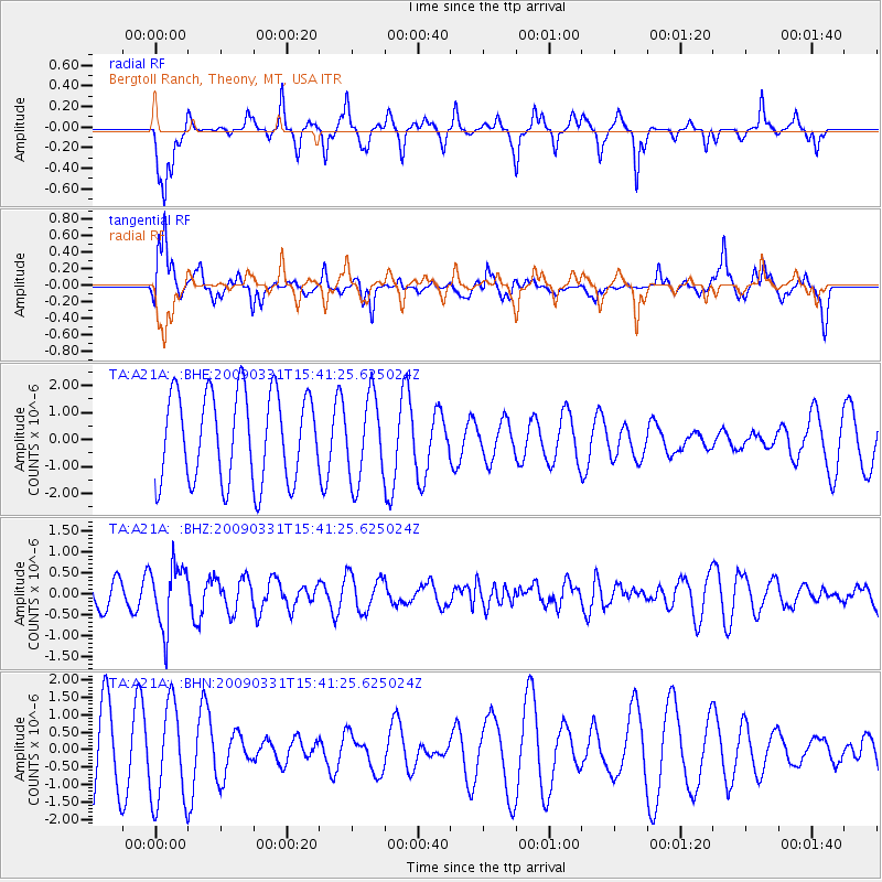
A21A Bergtoll Ranch, Theony, MT, USA - Earthquake Result Viewer
*The percent match for this event was below the threshold and hence no stack was calculated.
| Earthquake location: |
Mariana Islands |
| Earthquake latitude/longitude: |
18.3/145.7 |
| Earthquake time(UTC): |
2009/03/31 (090) 15:29:31 GMT |
| Earthquake Depth: |
188 km |
| Earthquake Magnitude: |
5.5 MW, 5.4 MB, 5.4 MW |
| Earthquake Catalog/Contributor: |
WHDF/NEIC |
|
| Network: |
TA USArray Transportable Network (new EarthScope stations) |
| Station: |
A21A Bergtoll Ranch, Theony, MT, USA |
| Lat/Lon: |
48.99 N/106.93 W |
| Elevation: |
779 m |
|
| Distance: |
87.2 deg |
| Az: |
39.007 deg |
| Baz: |
294.8 deg |
| Ray Param: |
$rayparam |
*The percent match for this event was below the threshold and hence was not used in the summary stack. |
|
| Radial Match: |
54.63799 % |
| Radial Bump: |
277 |
| Transverse Match: |
51.191902 % |
| Transverse Bump: |
337 |
| SOD ConfigId: |
2658 |
| Insert Time: |
2010-03-06 23:52:47.700 +0000 |
| GWidth: |
2.5 |
| Max Bumps: |
400 |
| Tol: |
0.001 |
|
Signal To Noise
| Channel | StoN | STA | LTA |
| TA:A21A: :BHZ:20090331T15:41:25.625024Z | 1.777732 | 7.5447844E-7 | 4.2440504E-7 |
| TA:A21A: :BHN:20090331T15:41:25.625024Z | 1.1895834 | 1.4155285E-6 | 1.1899364E-6 |
| TA:A21A: :BHE:20090331T15:41:25.625024Z | 0.9504637 | 1.5552741E-6 | 1.636332E-6 |
| Arrivals |
| Ps | |
| PpPs | |
| PsPs/PpSs | |


