You are here: Home > Network List > TA - USArray Transportable Network (new EarthScope stations) Stations List
> Station A21A Bergtoll Ranch, Theony, MT, USA > Earthquake Result Viewer
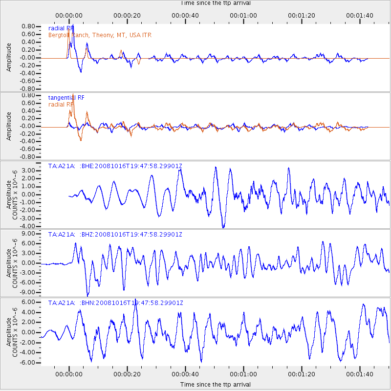
A21A Bergtoll Ranch, Theony, MT, USA - Earthquake Result Viewer
*The percent match for this event was below the threshold and hence no stack was calculated.
| Earthquake location: |
Near Coast Of Chiapas, Mexico |
| Earthquake latitude/longitude: |
14.4/-92.4 |
| Earthquake time(UTC): |
2008/10/16 (290) 19:41:25 GMT |
| Earthquake Depth: |
24 km |
| Earthquake Magnitude: |
6.1 MB, 6.6 MS, 6.7 MW, 6.6 MW |
| Earthquake Catalog/Contributor: |
WHDF/NEIC |
|
| Network: |
TA USArray Transportable Network (new EarthScope stations) |
| Station: |
A21A Bergtoll Ranch, Theony, MT, USA |
| Lat/Lon: |
48.99 N/106.93 W |
| Elevation: |
779 m |
|
| Distance: |
36.5 deg |
| Az: |
343.832 deg |
| Baz: |
155.821 deg |
| Ray Param: |
$rayparam |
*The percent match for this event was below the threshold and hence was not used in the summary stack. |
|
| Radial Match: |
91.348915 % |
| Radial Bump: |
296 |
| Transverse Match: |
60.120155 % |
| Transverse Bump: |
354 |
| SOD ConfigId: |
2556 |
| Insert Time: |
2010-03-06 23:53:02.584 +0000 |
| GWidth: |
2.5 |
| Max Bumps: |
400 |
| Tol: |
0.001 |
|
Signal To Noise
| Channel | StoN | STA | LTA |
| TA:A21A: :BHZ:20081016T19:47:58.29901Z | 8.054949 | 2.9576631E-6 | 3.6718586E-7 |
| TA:A21A: :BHN:20081016T19:47:58.29901Z | 5.506758 | 2.3738662E-6 | 4.3108236E-7 |
| TA:A21A: :BHE:20081016T19:47:58.29901Z | 1.9753743 | 1.4797307E-6 | 7.490887E-7 |
| Arrivals |
| Ps | |
| PpPs | |
| PsPs/PpSs | |


