You are here: Home > Network List > TA - USArray Transportable Network (new EarthScope stations) Stations List
> Station D24A Glendive, MT, USA > Earthquake Result Viewer
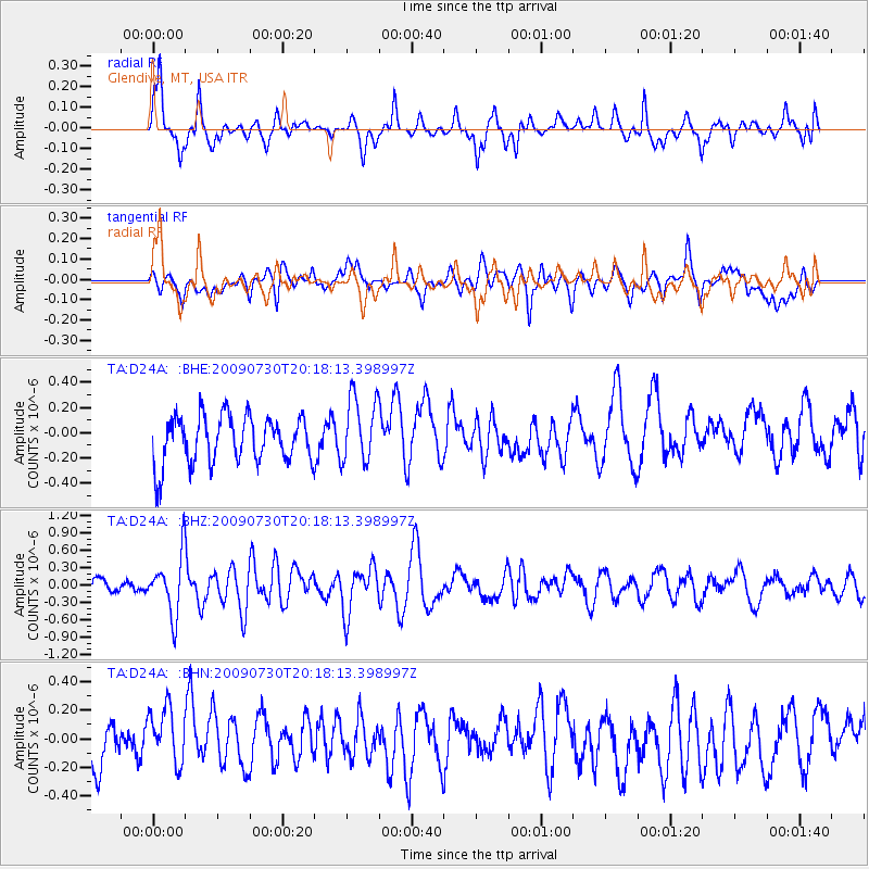
D24A Glendive, MT, USA - Earthquake Result Viewer
*The percent match for this event was below the threshold and hence no stack was calculated.
| Earthquake location: |
Tonga Islands |
| Earthquake latitude/longitude: |
-20.8/-174.3 |
| Earthquake time(UTC): |
2009/07/30 (211) 20:05:34 GMT |
| Earthquake Depth: |
10 km |
| Earthquake Magnitude: |
5.9 MB, 5.7 MS, 5.8 MW, 5.7 MW |
| Earthquake Catalog/Contributor: |
WHDF/NEIC |
|
| Network: |
TA USArray Transportable Network (new EarthScope stations) |
| Station: |
D24A Glendive, MT, USA |
| Lat/Lon: |
47.12 N/104.33 W |
| Elevation: |
766 m |
|
| Distance: |
92.2 deg |
| Az: |
39.94 deg |
| Baz: |
241.543 deg |
| Ray Param: |
$rayparam |
*The percent match for this event was below the threshold and hence was not used in the summary stack. |
|
| Radial Match: |
65.2415 % |
| Radial Bump: |
385 |
| Transverse Match: |
46.659416 % |
| Transverse Bump: |
400 |
| SOD ConfigId: |
2622 |
| Insert Time: |
2010-03-06 23:53:43.608 +0000 |
| GWidth: |
2.5 |
| Max Bumps: |
400 |
| Tol: |
0.001 |
|
Signal To Noise
| Channel | StoN | STA | LTA |
| TA:D24A: :BHZ:20090730T20:18:13.398997Z | 5.2293224 | 5.1181803E-7 | 9.787463E-8 |
| TA:D24A: :BHN:20090730T20:18:13.398997Z | 0.96286494 | 1.9345585E-7 | 2.009169E-7 |
| TA:D24A: :BHE:20090730T20:18:13.398997Z | 1.4340843 | 2.6784159E-7 | 1.8676836E-7 |
| Arrivals |
| Ps | |
| PpPs | |
| PsPs/PpSs | |


