You are here: Home > Network List > TA - USArray Transportable Network (new EarthScope stations) Stations List
> Station G16K Koyuk River, AK, USA > Earthquake Result Viewer
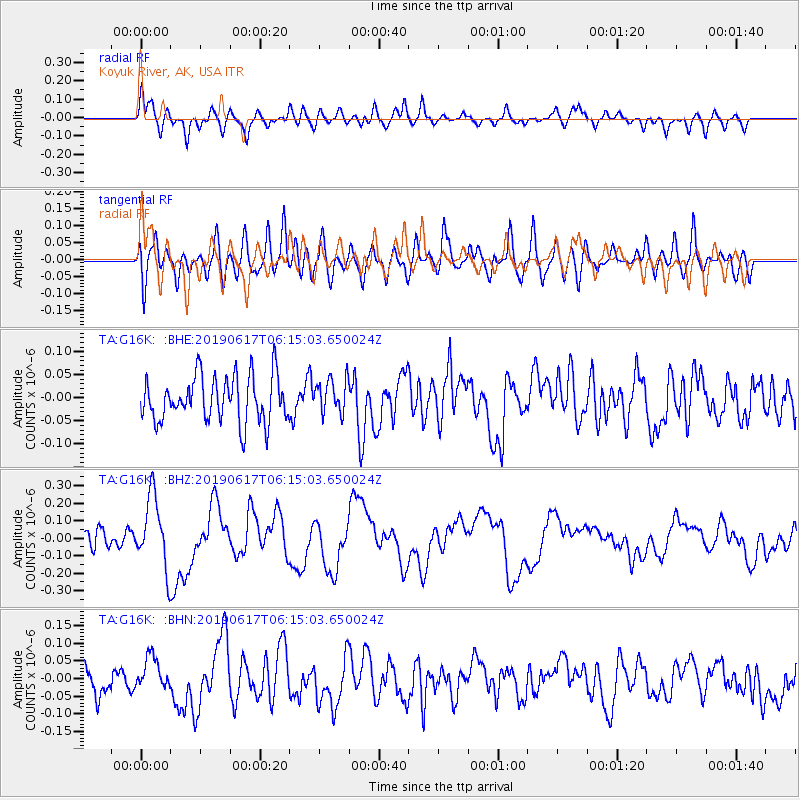
G16K Koyuk River, AK, USA - Earthquake Result Viewer
*The percent match for this event was below the threshold and hence no stack was calculated.
| Earthquake location: |
Kermadec Islands, New Zealand |
| Earthquake latitude/longitude: |
-30.9/-177.6 |
| Earthquake time(UTC): |
2019/06/17 (168) 06:02:05 GMT |
| Earthquake Depth: |
16 km |
| Earthquake Magnitude: |
6.0 Mww |
| Earthquake Catalog/Contributor: |
NEIC PDE/us |
|
| Network: |
TA USArray Transportable Network (new EarthScope stations) |
| Station: |
G16K Koyuk River, AK, USA |
| Lat/Lon: |
65.39 N/162.35 W |
| Elevation: |
169 m |
|
| Distance: |
96.7 deg |
| Az: |
6.364 deg |
| Baz: |
193.148 deg |
| Ray Param: |
$rayparam |
*The percent match for this event was below the threshold and hence was not used in the summary stack. |
|
| Radial Match: |
66.95271 % |
| Radial Bump: |
400 |
| Transverse Match: |
51.115795 % |
| Transverse Bump: |
400 |
| SOD ConfigId: |
18369291 |
| Insert Time: |
2019-07-01 06:07:27.288 +0000 |
| GWidth: |
2.5 |
| Max Bumps: |
400 |
| Tol: |
0.001 |
|
Signal To Noise
| Channel | StoN | STA | LTA |
| TA:G16K: :BHZ:20190617T06:15:03.650024Z | 4.343496 | 2.0261521E-7 | 4.664796E-8 |
| TA:G16K: :BHN:20190617T06:15:03.650024Z | 1.292181 | 4.706128E-8 | 3.6420037E-8 |
| TA:G16K: :BHE:20190617T06:15:03.650024Z | 0.76226836 | 3.772625E-8 | 4.949208E-8 |
| Arrivals |
| Ps | |
| PpPs | |
| PsPs/PpSs | |


