You are here: Home > Network List > US - United States National Seismic Network Stations List
> Station MSO Missoula, Montana, USA > Earthquake Result Viewer
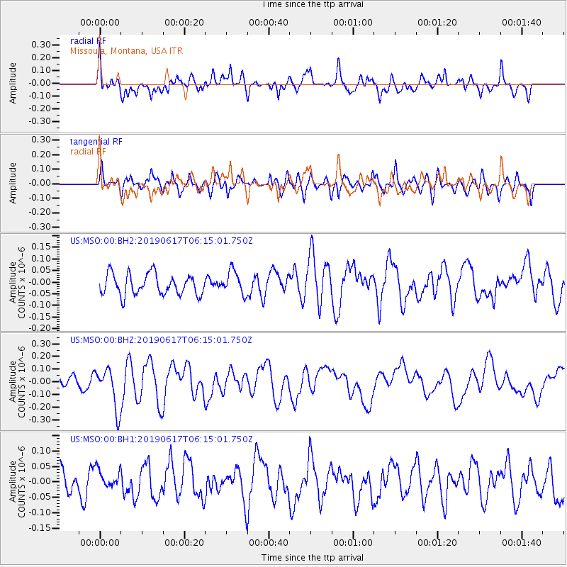
MSO Missoula, Montana, USA - Earthquake Result Viewer
*The percent match for this event was below the threshold and hence no stack was calculated.
| Earthquake location: |
Kermadec Islands, New Zealand |
| Earthquake latitude/longitude: |
-30.9/-177.6 |
| Earthquake time(UTC): |
2019/06/17 (168) 06:02:05 GMT |
| Earthquake Depth: |
16 km |
| Earthquake Magnitude: |
6.0 Mww |
| Earthquake Catalog/Contributor: |
NEIC PDE/us |
|
| Network: |
US United States National Seismic Network |
| Station: |
MSO Missoula, Montana, USA |
| Lat/Lon: |
46.83 N/113.94 W |
| Elevation: |
1264 m |
|
| Distance: |
96.3 deg |
| Az: |
38.249 deg |
| Baz: |
230.78 deg |
| Ray Param: |
$rayparam |
*The percent match for this event was below the threshold and hence was not used in the summary stack. |
|
| Radial Match: |
63.280693 % |
| Radial Bump: |
400 |
| Transverse Match: |
60.35463 % |
| Transverse Bump: |
400 |
| SOD ConfigId: |
18369291 |
| Insert Time: |
2019-07-01 06:08:49.632 +0000 |
| GWidth: |
2.5 |
| Max Bumps: |
400 |
| Tol: |
0.001 |
|
Signal To Noise
| Channel | StoN | STA | LTA |
| US:MSO:00:BHZ:20190617T06:15:01.750Z | 3.6690068 | 1.6709944E-7 | 4.5543512E-8 |
| US:MSO:00:BH1:20190617T06:15:01.750Z | 0.68369526 | 3.5075573E-8 | 5.1302933E-8 |
| US:MSO:00:BH2:20190617T06:15:01.750Z | 1.1578703 | 5.1760523E-8 | 4.4703214E-8 |
| Arrivals |
| Ps | |
| PpPs | |
| PsPs/PpSs | |


