You are here: Home > Network List > GS - US Geological Survey Networks Stations List
> Station KAN13 Rinehart Farm > Earthquake Result Viewer
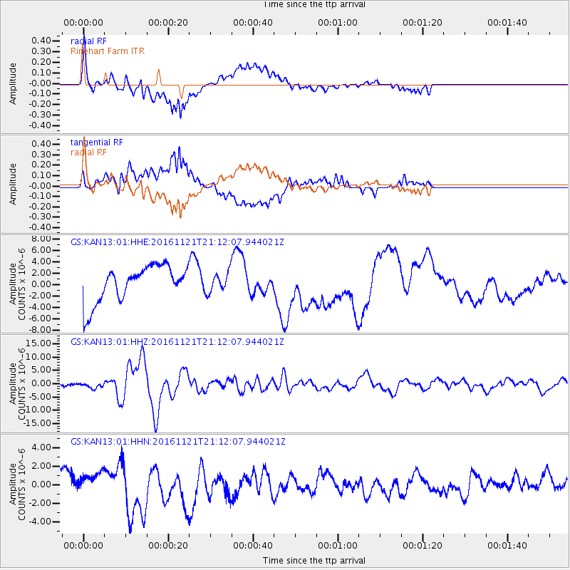
KAN13 Rinehart Farm - Earthquake Result Viewer
*The percent match for this event was below the threshold and hence no stack was calculated.
| Earthquake location: |
Near East Coast Of Honshu, Japan |
| Earthquake latitude/longitude: |
37.4/141.4 |
| Earthquake time(UTC): |
2016/11/21 (326) 20:59:49 GMT |
| Earthquake Depth: |
11 km |
| Earthquake Magnitude: |
6.9 MWB, 7.3 MI |
| Earthquake Catalog/Contributor: |
NEIC PDE/NEIC COMCAT |
|
| Network: |
GS US Geological Survey Networks |
| Station: |
KAN13 Rinehart Farm |
| Lat/Lon: |
37.01 N/97.48 W |
| Elevation: |
340 m |
|
| Distance: |
88.1 deg |
| Az: |
43.284 deg |
| Baz: |
316.983 deg |
| Ray Param: |
$rayparam |
*The percent match for this event was below the threshold and hence was not used in the summary stack. |
|
| Radial Match: |
60.148403 % |
| Radial Bump: |
400 |
| Transverse Match: |
38.588753 % |
| Transverse Bump: |
400 |
| SOD ConfigId: |
1858631 |
| Insert Time: |
2016-12-05 21:01:36.519 +0000 |
| GWidth: |
2.5 |
| Max Bumps: |
400 |
| Tol: |
0.001 |
|
Signal To Noise
| Channel | StoN | STA | LTA |
| GS:KAN13:01:HHZ:20161121T21:12:07.944021Z | 3.3364613 | 9.779462E-7 | 2.9310885E-7 |
| GS:KAN13:01:HHN:20161121T21:12:07.944021Z | 1.3126363 | 1.2484152E-6 | 9.5107475E-7 |
| GS:KAN13:01:HHE:20161121T21:12:07.944021Z | 0.5347926 | 1.6923284E-6 | 3.1644574E-6 |
| Arrivals |
| Ps | |
| PpPs | |
| PsPs/PpSs | |


