You are here: Home > Network List > TA - USArray Transportable Network (new EarthScope stations) Stations List
> Station D12A Red Ives Forest Station, Avery, ID, USA > Earthquake Result Viewer
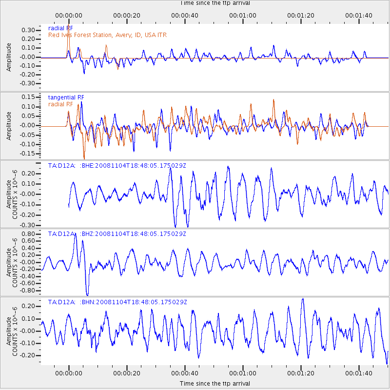
D12A Red Ives Forest Station, Avery, ID, USA - Earthquake Result Viewer
*The percent match for this event was below the threshold and hence no stack was calculated.
| Earthquake location: |
Vanuatu Islands |
| Earthquake latitude/longitude: |
-17.1/168.5 |
| Earthquake time(UTC): |
2008/11/04 (309) 18:35:45 GMT |
| Earthquake Depth: |
206 km |
| Earthquake Magnitude: |
5.7 MB, 6.3 MW, 6.3 MW |
| Earthquake Catalog/Contributor: |
WHDF/NEIC |
|
| Network: |
TA USArray Transportable Network (new EarthScope stations) |
| Station: |
D12A Red Ives Forest Station, Avery, ID, USA |
| Lat/Lon: |
47.05 N/115.35 W |
| Elevation: |
1135 m |
|
| Distance: |
93.3 deg |
| Az: |
41.691 deg |
| Baz: |
248.446 deg |
| Ray Param: |
$rayparam |
*The percent match for this event was below the threshold and hence was not used in the summary stack. |
|
| Radial Match: |
44.340885 % |
| Radial Bump: |
400 |
| Transverse Match: |
56.457214 % |
| Transverse Bump: |
340 |
| SOD ConfigId: |
2658 |
| Insert Time: |
2010-03-06 23:59:45.331 +0000 |
| GWidth: |
2.5 |
| Max Bumps: |
400 |
| Tol: |
0.001 |
|
Signal To Noise
| Channel | StoN | STA | LTA |
| TA:D12A: :BHZ:20081104T18:48:05.175029Z | 2.7896237 | 3.8359133E-7 | 1.3750648E-7 |
| TA:D12A: :BHN:20081104T18:48:05.175029Z | 0.8159494 | 8.2559275E-8 | 1.01181854E-7 |
| TA:D12A: :BHE:20081104T18:48:05.175029Z | 1.342732 | 8.0508535E-8 | 5.995875E-8 |
| Arrivals |
| Ps | |
| PpPs | |
| PsPs/PpSs | |


