You are here: Home > Network List > IU - Global Seismograph Network (GSN - IRIS/USGS) Stations List
> Station PMG Port Moresby, New Guinea > Earthquake Result Viewer
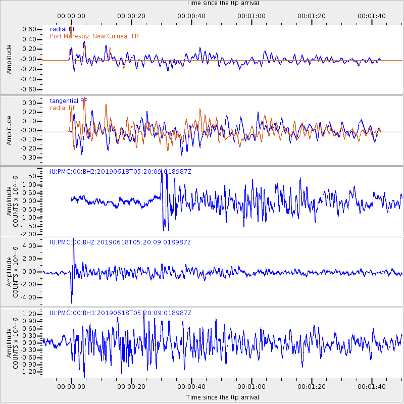
PMG Port Moresby, New Guinea - Earthquake Result Viewer
*The percent match for this event was below the threshold and hence no stack was calculated.
| Earthquake location: |
South Of Fiji Islands |
| Earthquake latitude/longitude: |
-25.5/178.2 |
| Earthquake time(UTC): |
2019/06/18 (169) 05:14:47 GMT |
| Earthquake Depth: |
599 km |
| Earthquake Magnitude: |
5.5 Mww |
| Earthquake Catalog/Contributor: |
NEIC PDE/us |
|
| Network: |
IU Global Seismograph Network (GSN - IRIS/USGS) |
| Station: |
PMG Port Moresby, New Guinea |
| Lat/Lon: |
9.40 S/147.16 E |
| Elevation: |
90 m |
|
| Distance: |
33.6 deg |
| Az: |
292.899 deg |
| Baz: |
122.472 deg |
| Ray Param: |
$rayparam |
*The percent match for this event was below the threshold and hence was not used in the summary stack. |
|
| Radial Match: |
69.74427 % |
| Radial Bump: |
400 |
| Transverse Match: |
62.82227 % |
| Transverse Bump: |
400 |
| SOD ConfigId: |
18369291 |
| Insert Time: |
2019-07-02 05:17:37.697 +0000 |
| GWidth: |
2.5 |
| Max Bumps: |
400 |
| Tol: |
0.001 |
|
Signal To Noise
| Channel | StoN | STA | LTA |
| IU:PMG:00:BHZ:20190618T05:20:09.018987Z | 13.963085 | 1.7313794E-6 | 1.2399691E-7 |
| IU:PMG:00:BH1:20190618T05:20:09.018987Z | 2.77605 | 5.316387E-7 | 1.9150906E-7 |
| IU:PMG:00:BH2:20190618T05:20:09.018987Z | 6.4228144 | 1.026718E-6 | 1.5985484E-7 |
| Arrivals |
| Ps | |
| PpPs | |
| PsPs/PpSs | |


