You are here: Home > Network List > TA - USArray Transportable Network (new EarthScope stations) Stations List
> Station P17K Kvichak River, AK, USA > Earthquake Result Viewer
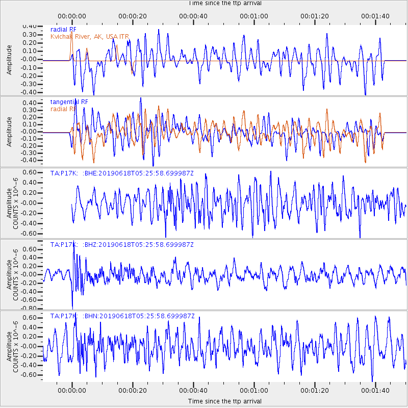
P17K Kvichak River, AK, USA - Earthquake Result Viewer
*The percent match for this event was below the threshold and hence no stack was calculated.
| Earthquake location: |
South Of Fiji Islands |
| Earthquake latitude/longitude: |
-25.5/178.2 |
| Earthquake time(UTC): |
2019/06/18 (169) 05:14:47 GMT |
| Earthquake Depth: |
599 km |
| Earthquake Magnitude: |
5.5 Mww |
| Earthquake Catalog/Contributor: |
NEIC PDE/us |
|
| Network: |
TA USArray Transportable Network (new EarthScope stations) |
| Station: |
P17K Kvichak River, AK, USA |
| Lat/Lon: |
59.20 N/156.44 W |
| Elevation: |
91 m |
|
| Distance: |
86.9 deg |
| Az: |
12.733 deg |
| Baz: |
202.77 deg |
| Ray Param: |
$rayparam |
*The percent match for this event was below the threshold and hence was not used in the summary stack. |
|
| Radial Match: |
62.56942 % |
| Radial Bump: |
400 |
| Transverse Match: |
57.177197 % |
| Transverse Bump: |
400 |
| SOD ConfigId: |
18369291 |
| Insert Time: |
2019-07-02 05:18:54.853 +0000 |
| GWidth: |
2.5 |
| Max Bumps: |
400 |
| Tol: |
0.001 |
|
Signal To Noise
| Channel | StoN | STA | LTA |
| TA:P17K: :BHZ:20190618T05:25:58.699987Z | 2.7126937 | 3.3586252E-7 | 1.2381145E-7 |
| TA:P17K: :BHN:20190618T05:25:58.699987Z | 1.597409 | 3.0273088E-7 | 1.8951368E-7 |
| TA:P17K: :BHE:20190618T05:25:58.699987Z | 1.441244 | 2.5301097E-7 | 1.755504E-7 |
| Arrivals |
| Ps | |
| PpPs | |
| PsPs/PpSs | |


