You are here: Home > Network List > AV - Alaska Volcano Observatory Stations List
> Station MAPS Pakushin Southeast, Makushin Volcano, Alaska > Earthquake Result Viewer
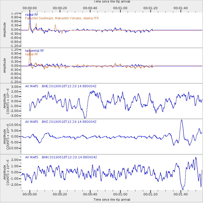
MAPS Pakushin Southeast, Makushin Volcano, Alaska - Earthquake Result Viewer
*The percent match for this event was below the threshold and hence no stack was calculated.
| Earthquake location: |
Near West Coast Of Honshu, Japan |
| Earthquake latitude/longitude: |
38.6/139.5 |
| Earthquake time(UTC): |
2019/06/18 (169) 13:22:19 GMT |
| Earthquake Depth: |
12 km |
| Earthquake Magnitude: |
6.4 Mww |
| Earthquake Catalog/Contributor: |
NEIC PDE/us |
|
| Network: |
AV Alaska Volcano Observatory |
| Station: |
MAPS Pakushin Southeast, Makushin Volcano, Alaska |
| Lat/Lon: |
53.81 N/166.94 W |
| Elevation: |
333 m |
|
| Distance: |
39.1 deg |
| Az: |
49.231 deg |
| Baz: |
269.51 deg |
| Ray Param: |
$rayparam |
*The percent match for this event was below the threshold and hence was not used in the summary stack. |
|
| Radial Match: |
79.92992 % |
| Radial Bump: |
400 |
| Transverse Match: |
59.49486 % |
| Transverse Bump: |
400 |
| SOD ConfigId: |
18369291 |
| Insert Time: |
2019-07-02 13:24:08.747 +0000 |
| GWidth: |
2.5 |
| Max Bumps: |
400 |
| Tol: |
0.001 |
|
Signal To Noise
| Channel | StoN | STA | LTA |
| AV:MAPS: :BHZ:20190618T13:29:14.880004Z | 2.439171 | 1.0837698E-6 | 4.4431889E-7 |
| AV:MAPS: :BHN:20190618T13:29:14.880004Z | 2.060668 | 9.075091E-7 | 4.403956E-7 |
| AV:MAPS: :BHE:20190618T13:29:14.880004Z | 1.345891 | 1.1772256E-6 | 8.7468123E-7 |
| Arrivals |
| Ps | |
| PpPs | |
| PsPs/PpSs | |


