You are here: Home > Network List > TA - USArray Transportable Network (new EarthScope stations) Stations List
> Station C12B Naegeli Ranch, Trout Creek, MT, USA > Earthquake Result Viewer
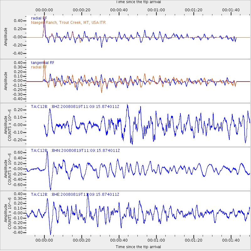
C12B Naegeli Ranch, Trout Creek, MT, USA - Earthquake Result Viewer
*The percent match for this event was below the threshold and hence no stack was calculated.
| Earthquake location: |
Easter Island Region |
| Earthquake latitude/longitude: |
-28.5/-112.8 |
| Earthquake time(UTC): |
2008/08/19 (232) 10:58:00 GMT |
| Earthquake Depth: |
9.0 km |
| Earthquake Magnitude: |
5.5 MB, 5.3 MS, 5.7 MW, 5.7 MW |
| Earthquake Catalog/Contributor: |
WHDF/NEIC |
|
| Network: |
TA USArray Transportable Network (new EarthScope stations) |
| Station: |
C12B Naegeli Ranch, Trout Creek, MT, USA |
| Lat/Lon: |
47.71 N/115.47 W |
| Elevation: |
801 m |
|
| Distance: |
75.9 deg |
| Az: |
358.167 deg |
| Baz: |
177.612 deg |
| Ray Param: |
$rayparam |
*The percent match for this event was below the threshold and hence was not used in the summary stack. |
|
| Radial Match: |
71.58958 % |
| Radial Bump: |
400 |
| Transverse Match: |
50.412495 % |
| Transverse Bump: |
400 |
| SOD ConfigId: |
2504 |
| Insert Time: |
2010-03-07 00:02:52.329 +0000 |
| GWidth: |
2.5 |
| Max Bumps: |
400 |
| Tol: |
0.001 |
|
Signal To Noise
| Channel | StoN | STA | LTA |
| TA:C12B: :BHN:20080819T11:09:15.874011Z | 9.090258 | 3.8197103E-7 | 4.2019824E-8 |
| TA:C12B: :BHE:20080819T11:09:15.874011Z | 3.7692258 | 2.0127096E-7 | 5.339849E-8 |
| TA:C12B: :BHZ:20080819T11:09:15.874011Z | 1.121977 | 7.654805E-8 | 6.822604E-8 |
| Arrivals |
| Ps | |
| PpPs | |
| PsPs/PpSs | |


