You are here: Home > Network List > TA - USArray Transportable Network (new EarthScope stations) Stations List
> Station C12B Naegeli Ranch, Trout Creek, MT, USA > Earthquake Result Viewer
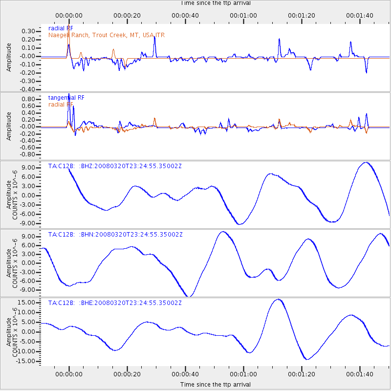
C12B Naegeli Ranch, Trout Creek, MT, USA - Earthquake Result Viewer
*The percent match for this event was below the threshold and hence no stack was calculated.
| Earthquake location: |
Southern Xinjiang, China |
| Earthquake latitude/longitude: |
35.5/81.4 |
| Earthquake time(UTC): |
2008/03/20 (080) 23:12:00 GMT |
| Earthquake Depth: |
10 km |
| Earthquake Magnitude: |
5.6 MB |
| Earthquake Catalog/Contributor: |
WHDF/NEIC |
|
| Network: |
TA USArray Transportable Network (new EarthScope stations) |
| Station: |
C12B Naegeli Ranch, Trout Creek, MT, USA |
| Lat/Lon: |
47.71 N/115.47 W |
| Elevation: |
801 m |
|
| Distance: |
95.8 deg |
| Az: |
11.386 deg |
| Baz: |
346.203 deg |
| Ray Param: |
$rayparam |
*The percent match for this event was below the threshold and hence was not used in the summary stack. |
|
| Radial Match: |
60.41975 % |
| Radial Bump: |
372 |
| Transverse Match: |
64.617386 % |
| Transverse Bump: |
311 |
| SOD ConfigId: |
2504 |
| Insert Time: |
2010-03-07 00:04:10.634 +0000 |
| GWidth: |
2.5 |
| Max Bumps: |
400 |
| Tol: |
0.001 |
|
Signal To Noise
| Channel | StoN | STA | LTA |
| TA:C12B: :BHN:20080320T23:24:55.35002Z | 2.4467907 | 8.482842E-6 | 3.4669256E-6 |
| TA:C12B: :BHE:20080320T23:24:55.35002Z | 0.67500275 | 3.420837E-6 | 5.067886E-6 |
| TA:C12B: :BHZ:20080320T23:24:55.35002Z | 0.25617924 | 8.995457E-7 | 3.511392E-6 |
| Arrivals |
| Ps | |
| PpPs | |
| PsPs/PpSs | |


