You are here: Home > Network List > TA - USArray Transportable Network (new EarthScope stations) Stations List
> Station C12B Naegeli Ranch, Trout Creek, MT, USA > Earthquake Result Viewer
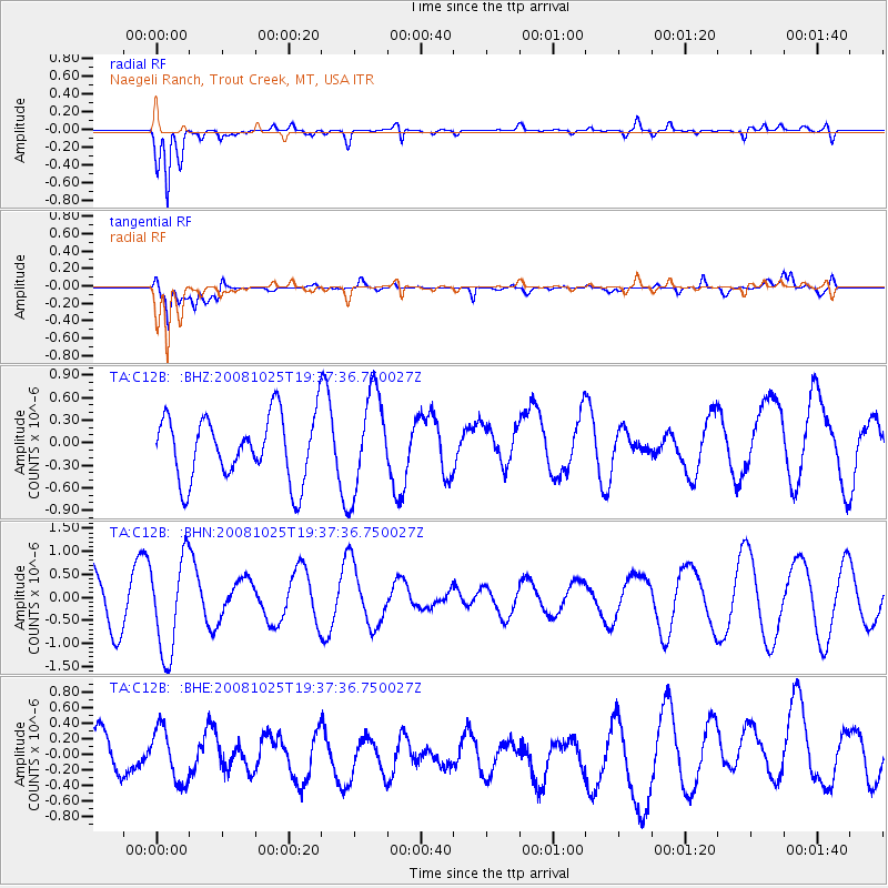
C12B Naegeli Ranch, Trout Creek, MT, USA - Earthquake Result Viewer
*The percent match for this event was below the threshold and hence no stack was calculated.
| Earthquake location: |
Vanuatu Islands |
| Earthquake latitude/longitude: |
-17.2/167.3 |
| Earthquake time(UTC): |
2008/10/25 (299) 19:24:50 GMT |
| Earthquake Depth: |
23 km |
| Earthquake Magnitude: |
5.7 MB, 5.3 MS, 5.7 MW, 5.7 MW |
| Earthquake Catalog/Contributor: |
WHDF/NEIC |
|
| Network: |
TA USArray Transportable Network (new EarthScope stations) |
| Station: |
C12B Naegeli Ranch, Trout Creek, MT, USA |
| Lat/Lon: |
47.71 N/115.47 W |
| Elevation: |
801 m |
|
| Distance: |
94.3 deg |
| Az: |
41.347 deg |
| Baz: |
249.201 deg |
| Ray Param: |
$rayparam |
*The percent match for this event was below the threshold and hence was not used in the summary stack. |
|
| Radial Match: |
75.87753 % |
| Radial Bump: |
400 |
| Transverse Match: |
62.148216 % |
| Transverse Bump: |
400 |
| SOD ConfigId: |
2560 |
| Insert Time: |
2010-03-07 00:04:51.780 +0000 |
| GWidth: |
2.5 |
| Max Bumps: |
400 |
| Tol: |
0.001 |
|
Signal To Noise
| Channel | StoN | STA | LTA |
| TA:C12B: :BHN:20081025T19:37:36.750027Z | 2.4766238 | 1.0365161E-6 | 4.1851982E-7 |
| TA:C12B: :BHE:20081025T19:37:36.750027Z | 1.0740976 | 3.6260374E-7 | 3.3758917E-7 |
| TA:C12B: :BHZ:20081025T19:37:36.750027Z | 1.5200764 | 6.529001E-7 | 4.2951797E-7 |
| Arrivals |
| Ps | |
| PpPs | |
| PsPs/PpSs | |


