You are here: Home > Network List > WY - Yellowstone Wyoming Seismic Network Stations List
> Station YHR Hawk's Rest, WY, USA > Earthquake Result Viewer
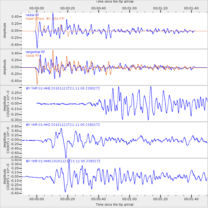
YHR Hawk's Rest, WY, USA - Earthquake Result Viewer
*The percent match for this event was below the threshold and hence no stack was calculated.
| Earthquake location: |
Near East Coast Of Honshu, Japan |
| Earthquake latitude/longitude: |
37.4/141.4 |
| Earthquake time(UTC): |
2016/11/21 (326) 20:59:49 GMT |
| Earthquake Depth: |
11 km |
| Earthquake Magnitude: |
6.9 MWB, 7.3 MI |
| Earthquake Catalog/Contributor: |
NEIC PDE/NEIC COMCAT |
|
| Network: |
WY Yellowstone Wyoming Seismic Network |
| Station: |
YHR Hawk's Rest, WY, USA |
| Lat/Lon: |
44.11 N/110.08 W |
| Elevation: |
2976 m |
|
| Distance: |
76.3 deg |
| Az: |
44.681 deg |
| Baz: |
308.975 deg |
| Ray Param: |
$rayparam |
*The percent match for this event was below the threshold and hence was not used in the summary stack. |
|
| Radial Match: |
94.96644 % |
| Radial Bump: |
400 |
| Transverse Match: |
92.94684 % |
| Transverse Bump: |
400 |
| SOD ConfigId: |
1858631 |
| Insert Time: |
2016-12-05 21:07:08.110 +0000 |
| GWidth: |
2.5 |
| Max Bumps: |
400 |
| Tol: |
0.001 |
|
Signal To Noise
| Channel | StoN | STA | LTA |
| WY:YHR:01:HHZ:20161121T21:11:06.238027Z | 11.068235 | 3.8595786E-8 | 3.4870764E-9 |
| WY:YHR:01:HHN:20161121T21:11:06.238027Z | 4.170763 | 3.0971947E-8 | 7.4259665E-9 |
| WY:YHR:01:HHE:20161121T21:11:06.238027Z | 2.2423077 | 1.3181022E-8 | 5.878329E-9 |
| Arrivals |
| Ps | |
| PpPs | |
| PsPs/PpSs | |


