You are here: Home > Network List > BK - Berkeley Digital Seismograph Network Stations List
> Station HUMO Hull Mountain, OR > Earthquake Result Viewer
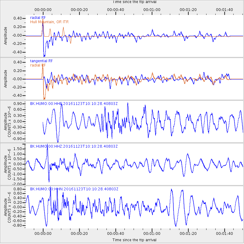
HUMO Hull Mountain, OR - Earthquake Result Viewer
*The percent match for this event was below the threshold and hence no stack was calculated.
| Earthquake location: |
Bonin Islands, Japan Region |
| Earthquake latitude/longitude: |
27.2/140.0 |
| Earthquake time(UTC): |
2016/11/23 (328) 09:59:56 GMT |
| Earthquake Depth: |
477 km |
| Earthquake Magnitude: |
5.7 MB |
| Earthquake Catalog/Contributor: |
NEIC PDE/NEIC COMCAT |
|
| Network: |
BK Berkeley Digital Seismograph Network |
| Station: |
HUMO Hull Mountain, OR |
| Lat/Lon: |
42.61 N/122.96 W |
| Elevation: |
555 m |
|
| Distance: |
76.9 deg |
| Az: |
48.779 deg |
| Baz: |
294.798 deg |
| Ray Param: |
$rayparam |
*The percent match for this event was below the threshold and hence was not used in the summary stack. |
|
| Radial Match: |
56.70182 % |
| Radial Bump: |
400 |
| Transverse Match: |
52.254738 % |
| Transverse Bump: |
400 |
| SOD ConfigId: |
1858631 |
| Insert Time: |
2016-12-07 10:00:29.377 +0000 |
| GWidth: |
2.5 |
| Max Bumps: |
400 |
| Tol: |
0.001 |
|
Signal To Noise
| Channel | StoN | STA | LTA |
| BK:HUMO:00:HHZ:20161123T10:10:28.40803Z | 1.9113501 | 7.498764E-7 | 3.923281E-7 |
| BK:HUMO:00:HHN:20161123T10:10:28.40803Z | 1.6842593 | 4.6642805E-7 | 2.7693363E-7 |
| BK:HUMO:00:HHE:20161123T10:10:28.40803Z | 0.8759888 | 3.4958344E-7 | 3.99073E-7 |
| Arrivals |
| Ps | |
| PpPs | |
| PsPs/PpSs | |


