You are here: Home > Network List > TA - USArray Transportable Network (new EarthScope stations) Stations List
> Station C17A Wharram Farm, Highwood, MT, USA > Earthquake Result Viewer
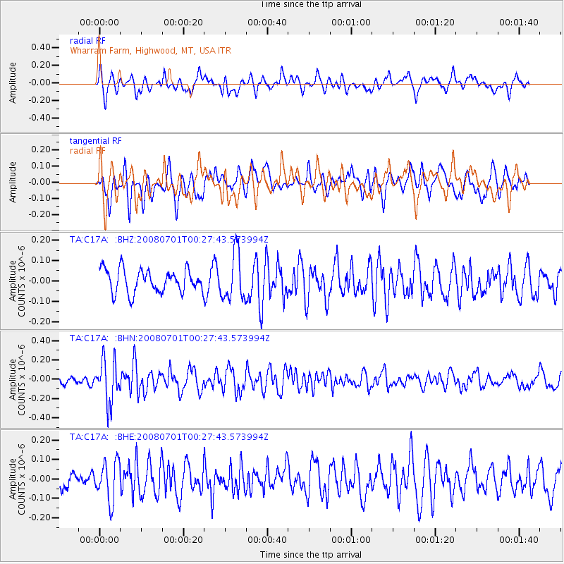
C17A Wharram Farm, Highwood, MT, USA - Earthquake Result Viewer
*The percent match for this event was below the threshold and hence no stack was calculated.
| Earthquake location: |
Central Peru |
| Earthquake latitude/longitude: |
-10.4/-75.5 |
| Earthquake time(UTC): |
2008/07/01 (183) 00:17:33 GMT |
| Earthquake Depth: |
33 km |
| Earthquake Magnitude: |
5.5 MW, 5.0 MS, 5.4 MB, 5.3 ML |
| Earthquake Catalog/Contributor: |
WHDF/NEIC |
|
| Network: |
TA USArray Transportable Network (new EarthScope stations) |
| Station: |
C17A Wharram Farm, Highwood, MT, USA |
| Lat/Lon: |
47.63 N/110.76 W |
| Elevation: |
1080 m |
|
| Distance: |
65.7 deg |
| Az: |
334.637 deg |
| Baz: |
141.456 deg |
| Ray Param: |
$rayparam |
*The percent match for this event was below the threshold and hence was not used in the summary stack. |
|
| Radial Match: |
67.44744 % |
| Radial Bump: |
400 |
| Transverse Match: |
57.049606 % |
| Transverse Bump: |
400 |
| SOD ConfigId: |
2504 |
| Insert Time: |
2010-03-07 00:09:09.624 +0000 |
| GWidth: |
2.5 |
| Max Bumps: |
400 |
| Tol: |
0.001 |
|
Signal To Noise
| Channel | StoN | STA | LTA |
| TA:C17A: :BHN:20080701T00:27:43.573994Z | 4.160758 | 2.2340082E-7 | 5.369234E-8 |
| TA:C17A: :BHE:20080701T00:27:43.573994Z | 1.9618739 | 1.04203345E-7 | 5.3114192E-8 |
| TA:C17A: :BHZ:20080701T00:27:43.573994Z | 2.0847957 | 1.17874706E-7 | 5.6540173E-8 |
| Arrivals |
| Ps | |
| PpPs | |
| PsPs/PpSs | |


