You are here: Home > Network List > TA - USArray Transportable Network (new EarthScope stations) Stations List
> Station C17A Wharram Farm, Highwood, MT, USA > Earthquake Result Viewer
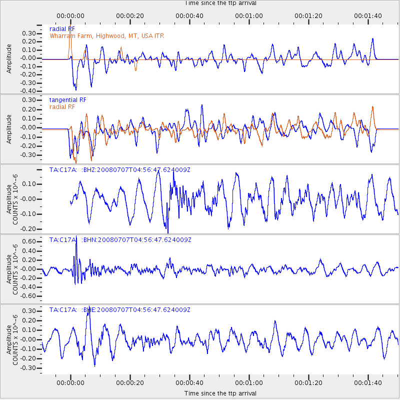
C17A Wharram Farm, Highwood, MT, USA - Earthquake Result Viewer
*The percent match for this event was below the threshold and hence no stack was calculated.
| Earthquake location: |
Tonga Islands |
| Earthquake latitude/longitude: |
-16.4/-174.0 |
| Earthquake time(UTC): |
2008/07/07 (189) 04:44:55 GMT |
| Earthquake Depth: |
116 km |
| Earthquake Magnitude: |
5.5 MW, 5.0 MB, 5.5 MW |
| Earthquake Catalog/Contributor: |
WHDF/NEIC |
|
| Network: |
TA USArray Transportable Network (new EarthScope stations) |
| Station: |
C17A Wharram Farm, Highwood, MT, USA |
| Lat/Lon: |
47.63 N/110.76 W |
| Elevation: |
1080 m |
|
| Distance: |
85.1 deg |
| Az: |
37.325 deg |
| Baz: |
239.355 deg |
| Ray Param: |
$rayparam |
*The percent match for this event was below the threshold and hence was not used in the summary stack. |
|
| Radial Match: |
58.597034 % |
| Radial Bump: |
400 |
| Transverse Match: |
36.628513 % |
| Transverse Bump: |
400 |
| SOD ConfigId: |
2504 |
| Insert Time: |
2010-03-07 00:09:12.178 +0000 |
| GWidth: |
2.5 |
| Max Bumps: |
400 |
| Tol: |
0.001 |
|
Signal To Noise
| Channel | StoN | STA | LTA |
| TA:C17A: :BHN:20080707T04:56:47.624009Z | 4.4677877 | 2.0917855E-7 | 4.6819267E-8 |
| TA:C17A: :BHE:20080707T04:56:47.624009Z | 1.3007019 | 9.836811E-8 | 7.562694E-8 |
| TA:C17A: :BHZ:20080707T04:56:47.624009Z | 1.8250426 | 1.3154956E-7 | 7.208026E-8 |
| Arrivals |
| Ps | |
| PpPs | |
| PsPs/PpSs | |


