You are here: Home > Network List > II - Global Seismograph Network (GSN - IRIS/IDA) Stations List
> Station WRAB Tennant Creek, NT, Australia > Earthquake Result Viewer
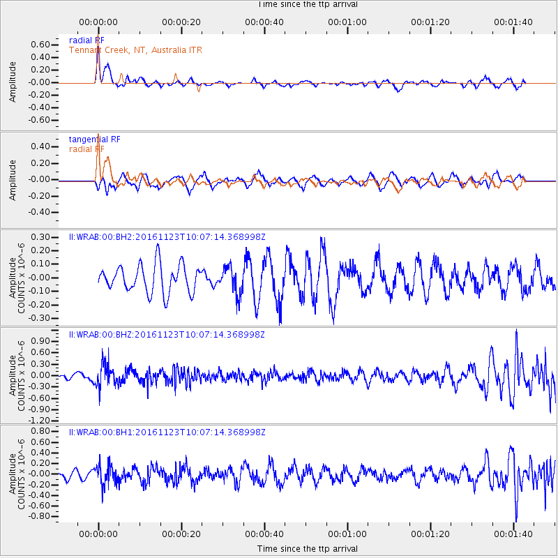
WRAB Tennant Creek, NT, Australia - Earthquake Result Viewer
*The percent match for this event was below the threshold and hence no stack was calculated.
| Earthquake location: |
Bonin Islands, Japan Region |
| Earthquake latitude/longitude: |
27.2/140.0 |
| Earthquake time(UTC): |
2016/11/23 (328) 09:59:56 GMT |
| Earthquake Depth: |
477 km |
| Earthquake Magnitude: |
5.7 MB |
| Earthquake Catalog/Contributor: |
NEIC PDE/NEIC COMCAT |
|
| Network: |
II Global Seismograph Network (GSN - IRIS/IDA) |
| Station: |
WRAB Tennant Creek, NT, Australia |
| Lat/Lon: |
19.93 S/134.36 E |
| Elevation: |
366 m |
|
| Distance: |
47.1 deg |
| Az: |
187.281 deg |
| Baz: |
6.893 deg |
| Ray Param: |
$rayparam |
*The percent match for this event was below the threshold and hence was not used in the summary stack. |
|
| Radial Match: |
45.560642 % |
| Radial Bump: |
313 |
| Transverse Match: |
65.275566 % |
| Transverse Bump: |
400 |
| SOD ConfigId: |
1858631 |
| Insert Time: |
2016-12-07 10:01:18.123 +0000 |
| GWidth: |
2.5 |
| Max Bumps: |
400 |
| Tol: |
0.001 |
|
Signal To Noise
| Channel | StoN | STA | LTA |
| II:WRAB:00:BHZ:20161123T10:07:14.368998Z | 2.9104445 | 2.8339605E-7 | 9.737207E-8 |
| II:WRAB:00:BH1:20161123T10:07:14.368998Z | 2.069285 | 1.8017352E-7 | 8.7070426E-8 |
| II:WRAB:00:BH2:20161123T10:07:14.368998Z | 0.9877965 | 9.980524E-8 | 1.0103826E-7 |
| Arrivals |
| Ps | |
| PpPs | |
| PsPs/PpSs | |


