You are here: Home > Network List > TA - USArray Transportable Network (new EarthScope stations) Stations List
> Station B21A Ellsworth Farm, Hinsdale, MT, USA > Earthquake Result Viewer
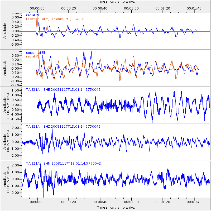
B21A Ellsworth Farm, Hinsdale, MT, USA - Earthquake Result Viewer
*The percent match for this event was below the threshold and hence no stack was calculated.
| Earthquake location: |
Arctic Ocean |
| Earthquake latitude/longitude: |
79.6/-116.1 |
| Earthquake time(UTC): |
2008/11/17 (322) 12:55:22 GMT |
| Earthquake Depth: |
7.0 km |
| Earthquake Magnitude: |
5.7 MW, 5.2 MS, 5.4 MB, 5.7 MW |
| Earthquake Catalog/Contributor: |
WHDF/NEIC |
|
| Network: |
TA USArray Transportable Network (new EarthScope stations) |
| Station: |
B21A Ellsworth Farm, Hinsdale, MT, USA |
| Lat/Lon: |
48.43 N/107.02 W |
| Elevation: |
661 m |
|
| Distance: |
31.5 deg |
| Az: |
168.449 deg |
| Baz: |
356.883 deg |
| Ray Param: |
$rayparam |
*The percent match for this event was below the threshold and hence was not used in the summary stack. |
|
| Radial Match: |
53.509308 % |
| Radial Bump: |
400 |
| Transverse Match: |
73.22204 % |
| Transverse Bump: |
376 |
| SOD ConfigId: |
2658 |
| Insert Time: |
2010-03-07 00:11:06.084 +0000 |
| GWidth: |
2.5 |
| Max Bumps: |
400 |
| Tol: |
0.001 |
|
Signal To Noise
| Channel | StoN | STA | LTA |
| TA:B21A: :BHZ:20081117T13:01:14.575004Z | 3.1108599 | 7.2418226E-7 | 2.3279168E-7 |
| TA:B21A: :BHN:20081117T13:01:14.575004Z | 1.7197586 | 9.739321E-7 | 5.6631904E-7 |
| TA:B21A: :BHE:20081117T13:01:14.575004Z | 0.8381174 | 3.834347E-7 | 4.5749522E-7 |
| Arrivals |
| Ps | |
| PpPs | |
| PsPs/PpSs | |


