You are here: Home > Network List > TA - USArray Transportable Network (new EarthScope stations) Stations List
> Station B21A Ellsworth Farm, Hinsdale, MT, USA > Earthquake Result Viewer
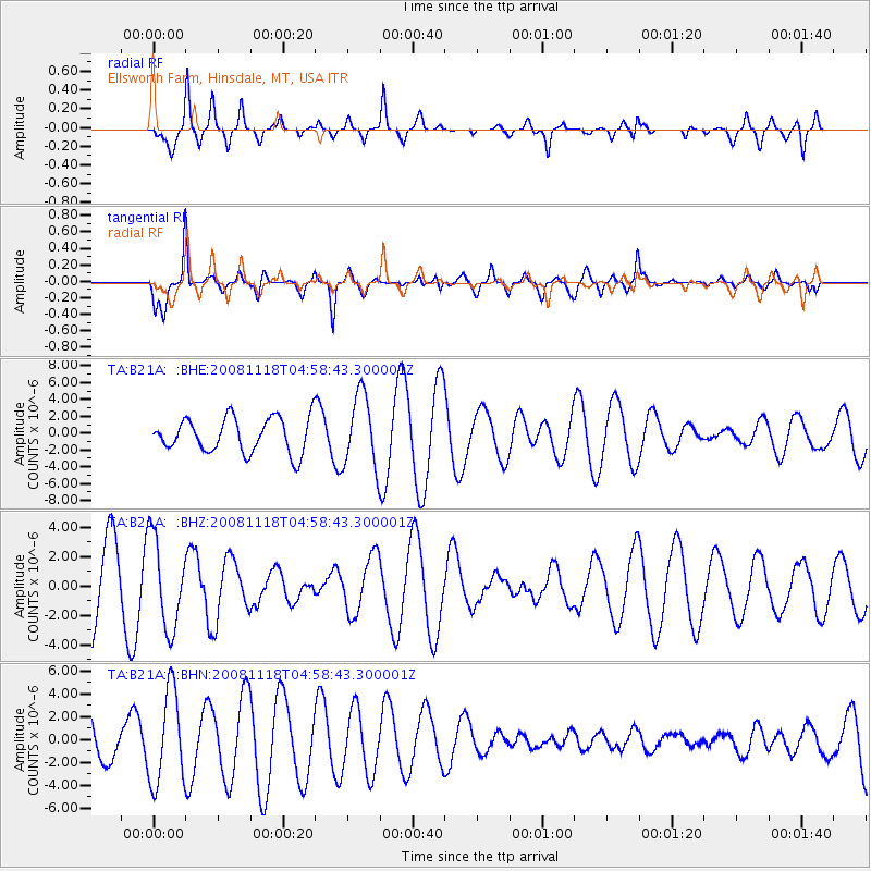
B21A Ellsworth Farm, Hinsdale, MT, USA - Earthquake Result Viewer
*The percent match for this event was below the threshold and hence no stack was calculated.
| Earthquake location: |
Arctic Ocean |
| Earthquake latitude/longitude: |
79.7/-115.5 |
| Earthquake time(UTC): |
2008/11/18 (323) 04:52:51 GMT |
| Earthquake Depth: |
10 km |
| Earthquake Magnitude: |
5.6 ML, 5.3 MB |
| Earthquake Catalog/Contributor: |
WHDF/NEIC |
|
| Network: |
TA USArray Transportable Network (new EarthScope stations) |
| Station: |
B21A Ellsworth Farm, Hinsdale, MT, USA |
| Lat/Lon: |
48.43 N/107.02 W |
| Elevation: |
661 m |
|
| Distance: |
31.6 deg |
| Az: |
169.246 deg |
| Baz: |
357.122 deg |
| Ray Param: |
$rayparam |
*The percent match for this event was below the threshold and hence was not used in the summary stack. |
|
| Radial Match: |
62.836025 % |
| Radial Bump: |
376 |
| Transverse Match: |
79.90208 % |
| Transverse Bump: |
386 |
| SOD ConfigId: |
2658 |
| Insert Time: |
2010-03-07 00:11:09.724 +0000 |
| GWidth: |
2.5 |
| Max Bumps: |
400 |
| Tol: |
0.001 |
|
Signal To Noise
| Channel | StoN | STA | LTA |
| TA:B21A: :BHZ:20081118T04:58:43.300001Z | 0.9756092 | 3.0969638E-6 | 3.1743898E-6 |
| TA:B21A: :BHN:20081118T04:58:43.300001Z | 1.8356332 | 4.0708082E-6 | 2.217659E-6 |
| TA:B21A: :BHE:20081118T04:58:43.300001Z | 2.1210043 | 4.344985E-6 | 2.0485506E-6 |
| Arrivals |
| Ps | |
| PpPs | |
| PsPs/PpSs | |


