You are here: Home > Network List > US - United States National Seismic Network Stations List
> Station WUAZ Wupatki, Arizona, USA > Earthquake Result Viewer
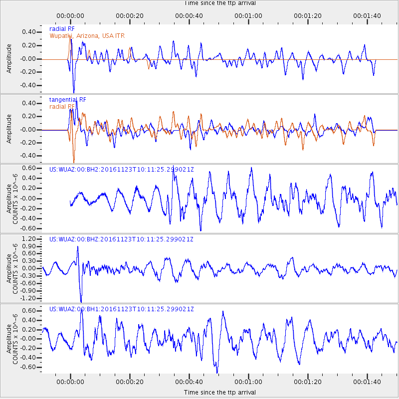
WUAZ Wupatki, Arizona, USA - Earthquake Result Viewer
*The percent match for this event was below the threshold and hence no stack was calculated.
| Earthquake location: |
Bonin Islands, Japan Region |
| Earthquake latitude/longitude: |
27.2/140.0 |
| Earthquake time(UTC): |
2016/11/23 (328) 09:59:56 GMT |
| Earthquake Depth: |
477 km |
| Earthquake Magnitude: |
5.7 MB |
| Earthquake Catalog/Contributor: |
NEIC PDE/NEIC COMCAT |
|
| Network: |
US United States National Seismic Network |
| Station: |
WUAZ Wupatki, Arizona, USA |
| Lat/Lon: |
35.52 N/111.37 W |
| Elevation: |
1592 m |
|
| Distance: |
88.2 deg |
| Az: |
50.673 deg |
| Baz: |
302.342 deg |
| Ray Param: |
$rayparam |
*The percent match for this event was below the threshold and hence was not used in the summary stack. |
|
| Radial Match: |
67.17333 % |
| Radial Bump: |
400 |
| Transverse Match: |
43.916264 % |
| Transverse Bump: |
361 |
| SOD ConfigId: |
1858631 |
| Insert Time: |
2016-12-07 10:03:02.058 +0000 |
| GWidth: |
2.5 |
| Max Bumps: |
400 |
| Tol: |
0.001 |
|
Signal To Noise
| Channel | StoN | STA | LTA |
| US:WUAZ:00:BHZ:20161123T10:11:25.299021Z | 4.6901855 | 5.1765375E-7 | 1.1036956E-7 |
| US:WUAZ:00:BH1:20161123T10:11:25.299021Z | 1.1360378 | 2.6916382E-7 | 2.3693208E-7 |
| US:WUAZ:00:BH2:20161123T10:11:25.299021Z | 2.393316 | 2.7741564E-7 | 1.1591267E-7 |
| Arrivals |
| Ps | |
| PpPs | |
| PsPs/PpSs | |


