You are here: Home > Network List > TA - USArray Transportable Network (new EarthScope stations) Stations List
> Station B21A Ellsworth Farm, Hinsdale, MT, USA > Earthquake Result Viewer
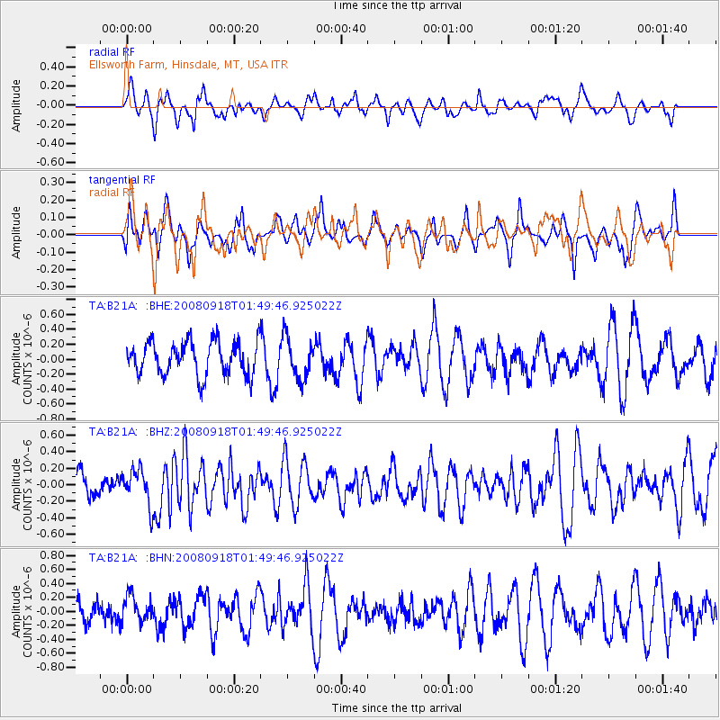
B21A Ellsworth Farm, Hinsdale, MT, USA - Earthquake Result Viewer
*The percent match for this event was below the threshold and hence no stack was calculated.
| Earthquake location: |
Central East Pacific Rise |
| Earthquake latitude/longitude: |
-4.6/-106.0 |
| Earthquake time(UTC): |
2008/09/18 (262) 01:41:02 GMT |
| Earthquake Depth: |
10 km |
| Earthquake Magnitude: |
5.5 MB, 5.7 MS, 6.0 MW, 6.0 MW |
| Earthquake Catalog/Contributor: |
WHDF/NEIC |
|
| Network: |
TA USArray Transportable Network (new EarthScope stations) |
| Station: |
B21A Ellsworth Farm, Hinsdale, MT, USA |
| Lat/Lon: |
48.43 N/107.02 W |
| Elevation: |
661 m |
|
| Distance: |
52.8 deg |
| Az: |
359.15 deg |
| Baz: |
178.727 deg |
| Ray Param: |
$rayparam |
*The percent match for this event was below the threshold and hence was not used in the summary stack. |
|
| Radial Match: |
46.458027 % |
| Radial Bump: |
383 |
| Transverse Match: |
32.100582 % |
| Transverse Bump: |
367 |
| SOD ConfigId: |
2560 |
| Insert Time: |
2010-03-07 00:12:27.980 +0000 |
| GWidth: |
2.5 |
| Max Bumps: |
400 |
| Tol: |
0.001 |
|
Signal To Noise
| Channel | StoN | STA | LTA |
| TA:B21A: :BHZ:20080918T01:49:46.925022Z | 2.0236895 | 2.1982028E-7 | 1.0862352E-7 |
| TA:B21A: :BHN:20080918T01:49:46.925022Z | 1.1865174 | 1.9264674E-7 | 1.623632E-7 |
| TA:B21A: :BHE:20080918T01:49:46.925022Z | 1.2110865 | 2.7319928E-7 | 2.2558196E-7 |
| Arrivals |
| Ps | |
| PpPs | |
| PsPs/PpSs | |


