You are here: Home > Network List > US - United States National Seismic Network Stations List
> Station MSO Missoula, Montana, USA > Earthquake Result Viewer
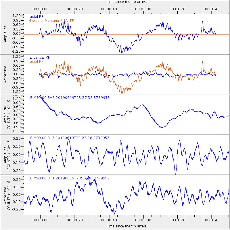
MSO Missoula, Montana, USA - Earthquake Result Viewer
*The percent match for this event was below the threshold and hence no stack was calculated.
| Earthquake location: |
Santa Cruz Islands |
| Earthquake latitude/longitude: |
-12.7/166.3 |
| Earthquake time(UTC): |
2019/06/19 (170) 23:14:59 GMT |
| Earthquake Depth: |
10 km |
| Earthquake Magnitude: |
5.7 Mww |
| Earthquake Catalog/Contributor: |
NEIC PDE/us |
|
| Network: |
US United States National Seismic Network |
| Station: |
MSO Missoula, Montana, USA |
| Lat/Lon: |
46.83 N/113.94 W |
| Elevation: |
1264 m |
|
| Distance: |
92.3 deg |
| Az: |
42.554 deg |
| Baz: |
254.014 deg |
| Ray Param: |
$rayparam |
*The percent match for this event was below the threshold and hence was not used in the summary stack. |
|
| Radial Match: |
26.82081 % |
| Radial Bump: |
400 |
| Transverse Match: |
40.835663 % |
| Transverse Bump: |
400 |
| SOD ConfigId: |
18369291 |
| Insert Time: |
2019-07-03 23:21:29.488 +0000 |
| GWidth: |
2.5 |
| Max Bumps: |
400 |
| Tol: |
0.001 |
|
Signal To Noise
| Channel | StoN | STA | LTA |
| US:MSO:00:BHZ:20190619T23:27:38.373995Z | 1.5672894 | 1.1162536E-7 | 7.122192E-8 |
| US:MSO:00:BH1:20190619T23:27:38.373995Z | 1.1428596 | 1.561105E-7 | 1.3659638E-7 |
| US:MSO:00:BH2:20190619T23:27:38.373995Z | 1.4041326 | 6.594501E-7 | 4.6964948E-7 |
| Arrivals |
| Ps | |
| PpPs | |
| PsPs/PpSs | |


