C22A Vida, MT, USA - Earthquake Result Viewer
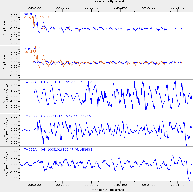
Earthquake location: Near Coast Of Chiapas, Mexico
Earthquake latitude/longitude: 14.4/-92.4
Earthquake time(UTC): 2008/10/16 (290) 19:41:25 GMT
Earthquake Depth: 24 km
Earthquake Magnitude: 6.1 MB, 6.6 MS, 6.7 MW, 6.6 MW
Earthquake Catalog/Contributor: WHDF/NEIC
Network: TA USArray Transportable Network (new EarthScope stations)
Station: C22A Vida, MT, USA
Lat/Lon: 47.75 N/105.88 W
Elevation: 745 m
Distance: 35.1 deg
Az: 344.063 deg
Baz: 156.784 deg
Ray Param: 0.077378854
Estimated Moho Depth: 17.0 km
Estimated Crust Vp/Vs: 1.79
Assumed Crust Vp: 6.438 km/s
Estimated Crust Vs: 3.591 km/s
Estimated Crust Poisson's Ratio: 0.27
Radial Match: 83.909355 %
Radial Bump: 283
Transverse Match: 54.910458 %
Transverse Bump: 396
SOD ConfigId: 2556
Insert Time: 2010-03-07 00:12:42.099 +0000
GWidth: 2.5
Max Bumps: 400
Tol: 0.001

Signal To Noise

ChannelStoNSTALTA
TA:C22A: :BHZ:20081016T19:47:46.148986Z11.65022853.01159E-62.585005E-7
TA:C22A: :BHN:20081016T19:47:46.148986Z1.81932321.4860091E-68.167923E-7
TA:C22A: :BHE:20081016T19:47:46.148986Z0.938810179.318923E-79.926313E-7
Arrivals
Ps2.3 SECOND
PpPs6.8 SECOND
PsPs/PpSs9.1 SECOND