You are here: Home > Network List > TA - USArray Transportable Network (new EarthScope stations) Stations List
> Station C22A Vida, MT, USA > Earthquake Result Viewer
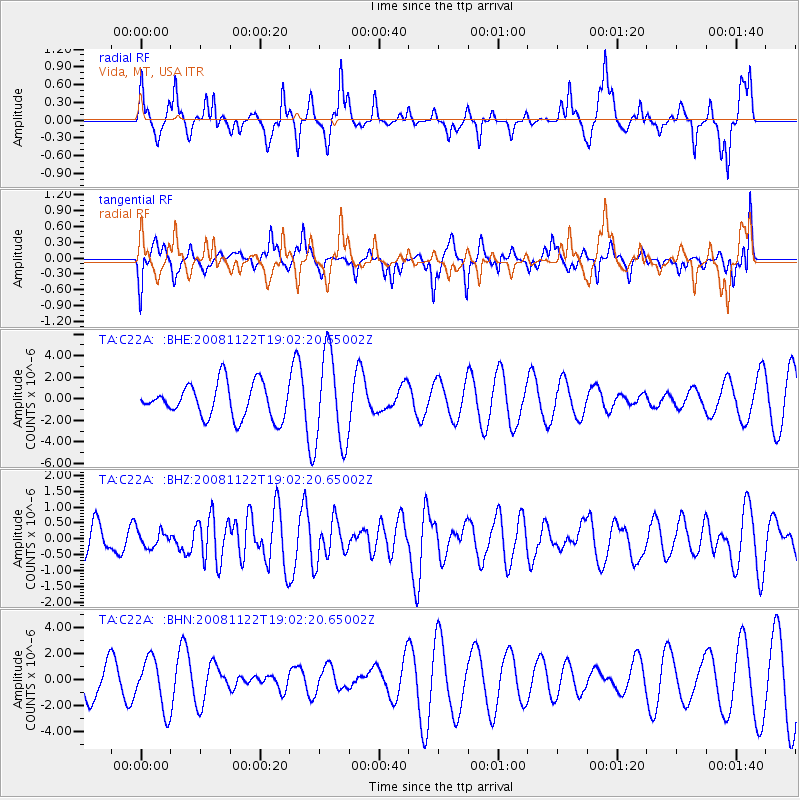
C22A Vida, MT, USA - Earthquake Result Viewer
*The percent match for this event was below the threshold and hence no stack was calculated.
| Earthquake location: |
North Of Ascension Island |
| Earthquake latitude/longitude: |
-1.2/-13.9 |
| Earthquake time(UTC): |
2008/11/22 (327) 18:49:42 GMT |
| Earthquake Depth: |
10 km |
| Earthquake Magnitude: |
5.9 MB, 6.0 MS, 6.3 MW, 6.2 MW |
| Earthquake Catalog/Contributor: |
WHDF/NEIC |
|
| Network: |
TA USArray Transportable Network (new EarthScope stations) |
| Station: |
C22A Vida, MT, USA |
| Lat/Lon: |
47.75 N/105.88 W |
| Elevation: |
745 m |
|
| Distance: |
92.2 deg |
| Az: |
317.545 deg |
| Baz: |
89.385 deg |
| Ray Param: |
$rayparam |
*The percent match for this event was below the threshold and hence was not used in the summary stack. |
|
| Radial Match: |
74.308334 % |
| Radial Bump: |
379 |
| Transverse Match: |
55.534885 % |
| Transverse Bump: |
388 |
| SOD ConfigId: |
2658 |
| Insert Time: |
2010-03-07 00:13:51.490 +0000 |
| GWidth: |
2.5 |
| Max Bumps: |
400 |
| Tol: |
0.001 |
|
Signal To Noise
| Channel | StoN | STA | LTA |
| TA:C22A: :BHZ:20081122T19:02:20.65002Z | 0.72068864 | 2.605896E-7 | 3.6158414E-7 |
| TA:C22A: :BHN:20081122T19:02:20.65002Z | 0.9532666 | 1.9571835E-6 | 2.0531334E-6 |
| TA:C22A: :BHE:20081122T19:02:20.65002Z | 2.738869 | 4.2862976E-6 | 1.5649882E-6 |
| Arrivals |
| Ps | |
| PpPs | |
| PsPs/PpSs | |


