You are here: Home > Network List > US - United States National Seismic Network Stations List
> Station HAWA Hanford, Washington, USA > Earthquake Result Viewer
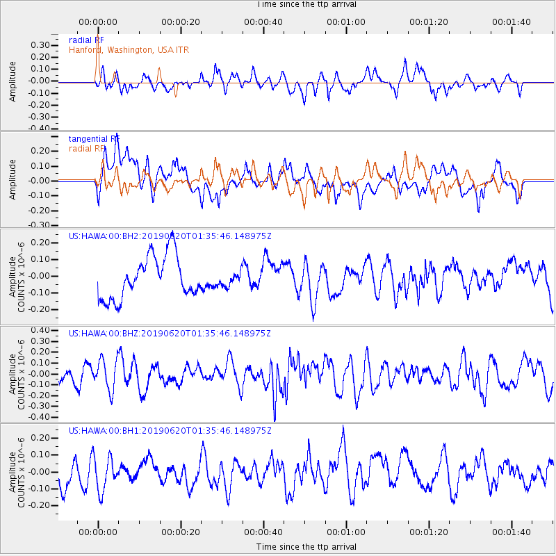
HAWA Hanford, Washington, USA - Earthquake Result Viewer
*The percent match for this event was below the threshold and hence no stack was calculated.
| Earthquake location: |
Mendoza Province, Argentina |
| Earthquake latitude/longitude: |
-33.6/-68.8 |
| Earthquake time(UTC): |
2019/06/20 (171) 01:23:26 GMT |
| Earthquake Depth: |
149 km |
| Earthquake Magnitude: |
5.5 Mww |
| Earthquake Catalog/Contributor: |
NEIC PDE/us |
|
| Network: |
US United States National Seismic Network |
| Station: |
HAWA Hanford, Washington, USA |
| Lat/Lon: |
46.39 N/119.53 W |
| Elevation: |
364 m |
|
| Distance: |
91.9 deg |
| Az: |
327.578 deg |
| Baz: |
139.747 deg |
| Ray Param: |
$rayparam |
*The percent match for this event was below the threshold and hence was not used in the summary stack. |
|
| Radial Match: |
38.824383 % |
| Radial Bump: |
400 |
| Transverse Match: |
54.707268 % |
| Transverse Bump: |
400 |
| SOD ConfigId: |
18369291 |
| Insert Time: |
2019-07-04 01:29:09.413 +0000 |
| GWidth: |
2.5 |
| Max Bumps: |
400 |
| Tol: |
0.001 |
|
Signal To Noise
| Channel | StoN | STA | LTA |
| US:HAWA:00:BHZ:20190620T01:35:46.148975Z | 1.549085 | 1.4612226E-7 | 9.432811E-8 |
| US:HAWA:00:BH1:20190620T01:35:46.148975Z | 1.3657075 | 1.0536414E-7 | 7.7149856E-8 |
| US:HAWA:00:BH2:20190620T01:35:46.148975Z | 0.3260755 | 4.1023647E-8 | 1.2581026E-7 |
| Arrivals |
| Ps | |
| PpPs | |
| PsPs/PpSs | |


