You are here: Home > Network List > TA - USArray Transportable Network (new EarthScope stations) Stations List
> Station C22A Vida, MT, USA > Earthquake Result Viewer
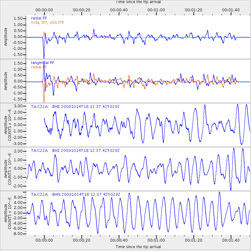
C22A Vida, MT, USA - Earthquake Result Viewer
*The percent match for this event was below the threshold and hence no stack was calculated.
| Earthquake location: |
Samoa Islands Region |
| Earthquake latitude/longitude: |
-14.9/-174.8 |
| Earthquake time(UTC): |
2009/10/14 (287) 18:00:21 GMT |
| Earthquake Depth: |
10 km |
| Earthquake Magnitude: |
5.7 MB, 6.0 MS, 6.3 MW, 6.2 MW |
| Earthquake Catalog/Contributor: |
WHDF/NEIC |
|
| Network: |
TA USArray Transportable Network (new EarthScope stations) |
| Station: |
C22A Vida, MT, USA |
| Lat/Lon: |
47.75 N/105.88 W |
| Elevation: |
745 m |
|
| Distance: |
87.4 deg |
| Az: |
39.085 deg |
| Baz: |
244.572 deg |
| Ray Param: |
$rayparam |
*The percent match for this event was below the threshold and hence was not used in the summary stack. |
|
| Radial Match: |
43.082058 % |
| Radial Bump: |
400 |
| Transverse Match: |
29.72916 % |
| Transverse Bump: |
308 |
| SOD ConfigId: |
2622 |
| Insert Time: |
2010-03-07 00:14:13.636 +0000 |
| GWidth: |
2.5 |
| Max Bumps: |
400 |
| Tol: |
0.001 |
|
Signal To Noise
| Channel | StoN | STA | LTA |
| TA:C22A: :BHZ:20091014T18:12:37.425029Z | 0.70850414 | 4.5836518E-7 | 6.469478E-7 |
| TA:C22A: :BHN:20091014T18:12:37.425029Z | 1.9684291 | 2.8485804E-6 | 1.4471337E-6 |
| TA:C22A: :BHE:20091014T18:12:37.425029Z | 0.7951285 | 8.6083276E-7 | 1.0826335E-6 |
| Arrivals |
| Ps | |
| PpPs | |
| PsPs/PpSs | |


