You are here: Home > Network List > CI - Caltech Regional Seismic Network Stations List
> Station MPP McPhearson Peak > Earthquake Result Viewer
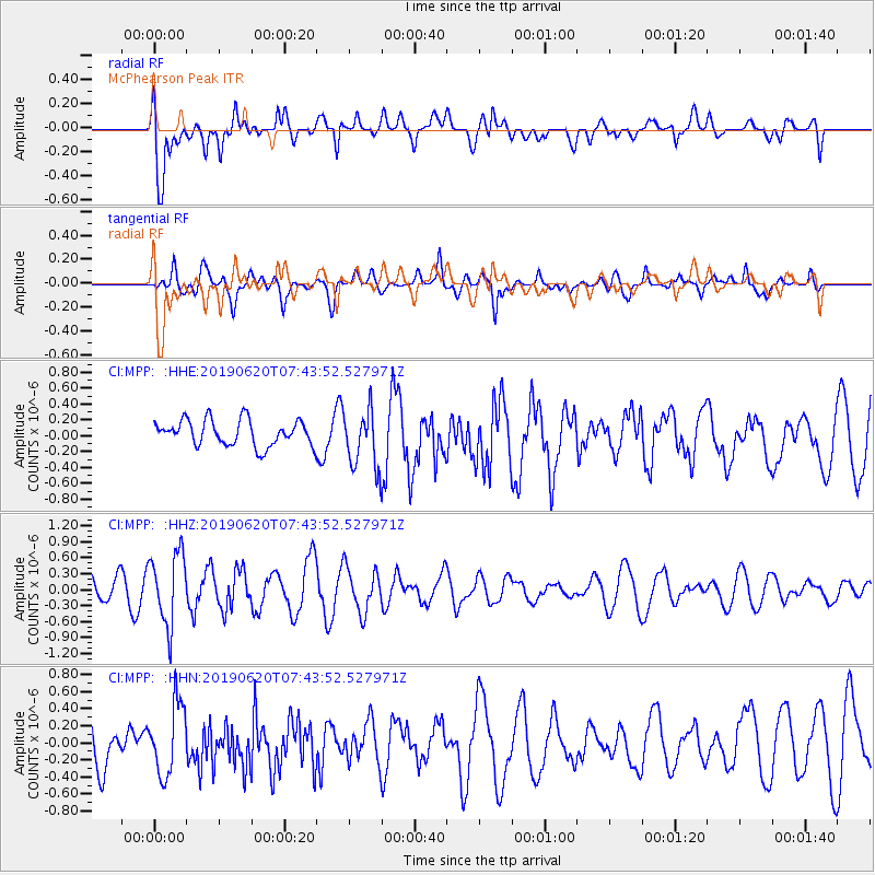
MPP McPhearson Peak - Earthquake Result Viewer
*The percent match for this event was below the threshold and hence no stack was calculated.
| Earthquake location: |
Tonga Islands |
| Earthquake latitude/longitude: |
-17.7/-173.7 |
| Earthquake time(UTC): |
2019/06/20 (171) 07:32:57 GMT |
| Earthquake Depth: |
42 km |
| Earthquake Magnitude: |
5.6 mb |
| Earthquake Catalog/Contributor: |
NEIC PDE/us |
|
| Network: |
CI Caltech Regional Seismic Network |
| Station: |
MPP McPhearson Peak |
| Lat/Lon: |
34.89 N/119.81 W |
| Elevation: |
1739 m |
|
| Distance: |
73.1 deg |
| Az: |
43.954 deg |
| Baz: |
233.613 deg |
| Ray Param: |
$rayparam |
*The percent match for this event was below the threshold and hence was not used in the summary stack. |
|
| Radial Match: |
67.381966 % |
| Radial Bump: |
400 |
| Transverse Match: |
56.527027 % |
| Transverse Bump: |
400 |
| SOD ConfigId: |
18369291 |
| Insert Time: |
2019-07-04 07:35:47.110 +0000 |
| GWidth: |
2.5 |
| Max Bumps: |
400 |
| Tol: |
0.001 |
|
Signal To Noise
| Channel | StoN | STA | LTA |
| CI:MPP: :HHZ:20190620T07:43:52.527971Z | 2.532771 | 6.723513E-7 | 2.6546076E-7 |
| CI:MPP: :HHN:20190620T07:43:52.527971Z | 0.95809674 | 4.0962135E-7 | 4.2753652E-7 |
| CI:MPP: :HHE:20190620T07:43:52.527971Z | 2.2714548 | 3.6666182E-7 | 1.6142158E-7 |
| Arrivals |
| Ps | |
| PpPs | |
| PsPs/PpSs | |


