You are here: Home > Network List > IW - Intermountain West Stations List
> Station IMW Indian Meadow, Wyoming, USA > Earthquake Result Viewer
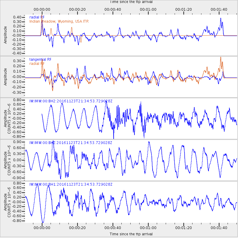
IMW Indian Meadow, Wyoming, USA - Earthquake Result Viewer
*The percent match for this event was below the threshold and hence no stack was calculated.
| Earthquake location: |
Near East Coast Of Honshu, Japan |
| Earthquake latitude/longitude: |
37.2/141.3 |
| Earthquake time(UTC): |
2016/11/23 (328) 21:23:37 GMT |
| Earthquake Depth: |
10 km |
| Earthquake Magnitude: |
5.6 MB |
| Earthquake Catalog/Contributor: |
NEIC PDE/NEIC COMCAT |
|
| Network: |
IW Intermountain West |
| Station: |
IMW Indian Meadow, Wyoming, USA |
| Lat/Lon: |
43.90 N/110.94 W |
| Elevation: |
2646 m |
|
| Distance: |
76.1 deg |
| Az: |
45.173 deg |
| Baz: |
308.472 deg |
| Ray Param: |
$rayparam |
*The percent match for this event was below the threshold and hence was not used in the summary stack. |
|
| Radial Match: |
46.61901 % |
| Radial Bump: |
400 |
| Transverse Match: |
46.561344 % |
| Transverse Bump: |
400 |
| SOD ConfigId: |
1858631 |
| Insert Time: |
2016-12-07 21:26:46.045 +0000 |
| GWidth: |
2.5 |
| Max Bumps: |
400 |
| Tol: |
0.001 |
|
Signal To Noise
| Channel | StoN | STA | LTA |
| IW:IMW:00:BHZ:20161123T21:34:53.729028Z | 1.1420974 | 3.0219698E-7 | 2.6459827E-7 |
| IW:IMW:00:BH1:20161123T21:34:53.729028Z | 2.120879 | 5.8226027E-7 | 2.7453726E-7 |
| IW:IMW:00:BH2:20161123T21:34:53.729028Z | 1.1417515 | 4.1542427E-7 | 3.6384822E-7 |
| Arrivals |
| Ps | |
| PpPs | |
| PsPs/PpSs | |


