C23A Lambert, MT, USA - Earthquake Result Viewer
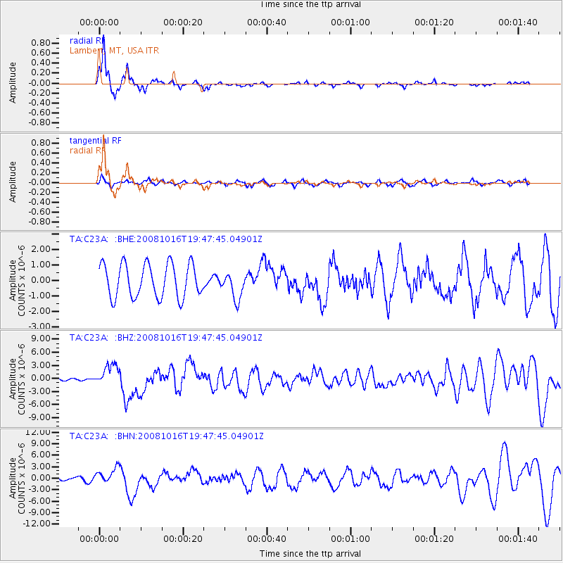
Earthquake location: Near Coast Of Chiapas, Mexico
Earthquake latitude/longitude: 14.4/-92.4
Earthquake time(UTC): 2008/10/16 (290) 19:41:25 GMT
Earthquake Depth: 24 km
Earthquake Magnitude: 6.1 MB, 6.6 MS, 6.7 MW, 6.6 MW
Earthquake Catalog/Contributor: WHDF/NEIC
Network: TA USArray Transportable Network (new EarthScope stations)
Station: C23A Lambert, MT, USA
Lat/Lon: 47.80 N/105.18 W
Elevation: 729 m
Distance: 34.9 deg
Az: 344.86 deg
Baz: 157.954 deg
Ray Param: 0.0774455
Estimated Moho Depth: 20.5 km
Estimated Crust Vp/Vs: 1.64
Assumed Crust Vp: 6.438 km/s
Estimated Crust Vs: 3.925 km/s
Estimated Crust Poisson's Ratio: 0.20
Radial Match: 91.59804 %
Radial Bump: 214
Transverse Match: 59.513767 %
Transverse Bump: 314
SOD ConfigId: 2556
Insert Time: 2010-03-07 00:15:22.127 +0000
GWidth: 2.5
Max Bumps: 400
Tol: 0.001

Signal To Noise

ChannelStoNSTALTA
TA:C23A: :BHZ:20081016T19:47:45.04901Z8.8215622.529564E-62.8674785E-7
TA:C23A: :BHN:20081016T19:47:45.04901Z3.9398152.092139E-65.310247E-7
TA:C23A: :BHE:20081016T19:47:45.04901Z0.822190648.908173E-71.0834681E-6
Arrivals
Ps2.2 SECOND
PpPs7.7 SECOND
PsPs/PpSs10.0 SECOND