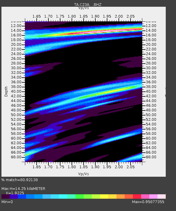
C23A Lambert, MT, USA - Earthquake Result Viewer
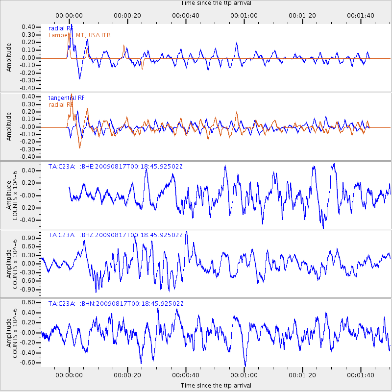
Earthquake location: Southwestern Ryukyu Isl., Japan
Earthquake latitude/longitude: 23.5/123.5
Earthquake time(UTC): 2009/08/17 (229) 00:05:49 GMT
Earthquake Depth: 20 km
Earthquake Magnitude: 6.2 MB, 6.6 MS, 6.7 MW, 6.6 MW
Earthquake Catalog/Contributor: WHDF/NEIC
Network: TA USArray Transportable Network (new EarthScope stations)
Station: C23A Lambert, MT, USA
Lat/Lon: 47.80 N/105.18 W
Elevation: 729 m
Distance: 96.6 deg
Az: 30.648 deg
Baz: 316.039 deg
Ray Param: 0.040446315
Estimated Moho Depth: 14.25 km
Estimated Crust Vp/Vs: 1.92
Assumed Crust Vp: 6.438 km/s
Estimated Crust Vs: 3.349 km/s
Estimated Crust Poisson's Ratio: 0.31
Radial Match: 80.92138 %
Radial Bump: 400
Transverse Match: 61.505524 %
Transverse Bump: 400
SOD ConfigId: 2622
Insert Time: 2010-03-07 00:15:41.183 +0000
GWidth: 2.5
Max Bumps: 400
Tol: 0.001

Signal To Noise

ChannelStoNSTALTA
TA:C23A: :BHZ:20090817T00:18:45.92502Z2.9090772.817472E-79.685106E-8
TA:C23A: :BHN:20090817T00:18:45.92502Z1.48463481.5297027E-71.0303563E-7
TA:C23A: :BHE:20090817T00:18:45.92502Z1.67329011.4459326E-78.641254E-8
Arrivals
Ps2.1 SECOND
PpPs6.4 SECOND
PsPs/PpSs8.4 SECOND