You are here: Home > Network List > TA - USArray Transportable Network (new EarthScope stations) Stations List
> Station F21K Alatna River, AK, USA > Earthquake Result Viewer
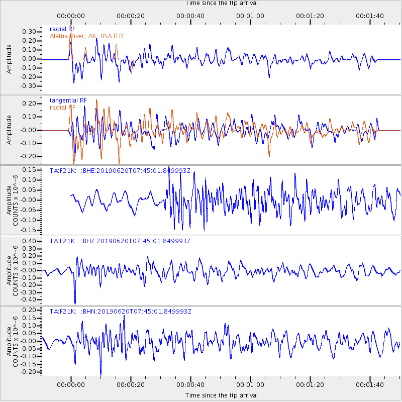
F21K Alatna River, AK, USA - Earthquake Result Viewer
*The percent match for this event was below the threshold and hence no stack was calculated.
| Earthquake location: |
Tonga Islands |
| Earthquake latitude/longitude: |
-17.7/-173.7 |
| Earthquake time(UTC): |
2019/06/20 (171) 07:32:57 GMT |
| Earthquake Depth: |
42 km |
| Earthquake Magnitude: |
5.6 mb |
| Earthquake Catalog/Contributor: |
NEIC PDE/us |
|
| Network: |
TA USArray Transportable Network (new EarthScope stations) |
| Station: |
F21K Alatna River, AK, USA |
| Lat/Lon: |
67.22 N/153.48 W |
| Elevation: |
597 m |
|
| Distance: |
85.9 deg |
| Az: |
7.758 deg |
| Baz: |
199.302 deg |
| Ray Param: |
$rayparam |
*The percent match for this event was below the threshold and hence was not used in the summary stack. |
|
| Radial Match: |
62.324394 % |
| Radial Bump: |
400 |
| Transverse Match: |
50.94291 % |
| Transverse Bump: |
400 |
| SOD ConfigId: |
18369291 |
| Insert Time: |
2019-07-04 07:39:28.281 +0000 |
| GWidth: |
2.5 |
| Max Bumps: |
400 |
| Tol: |
0.001 |
|
Signal To Noise
| Channel | StoN | STA | LTA |
| TA:F21K: :BHZ:20190620T07:45:01.849993Z | 4.7139163 | 1.3775286E-7 | 2.9222594E-8 |
| TA:F21K: :BHN:20190620T07:45:01.849993Z | 1.7061131 | 5.5921383E-8 | 3.2777066E-8 |
| TA:F21K: :BHE:20190620T07:45:01.849993Z | 2.1092007 | 6.151922E-8 | 2.916708E-8 |
| Arrivals |
| Ps | |
| PpPs | |
| PsPs/PpSs | |


