You are here: Home > Network List > TA - USArray Transportable Network (new EarthScope stations) Stations List
> Station H16K Elim, AK, USA > Earthquake Result Viewer
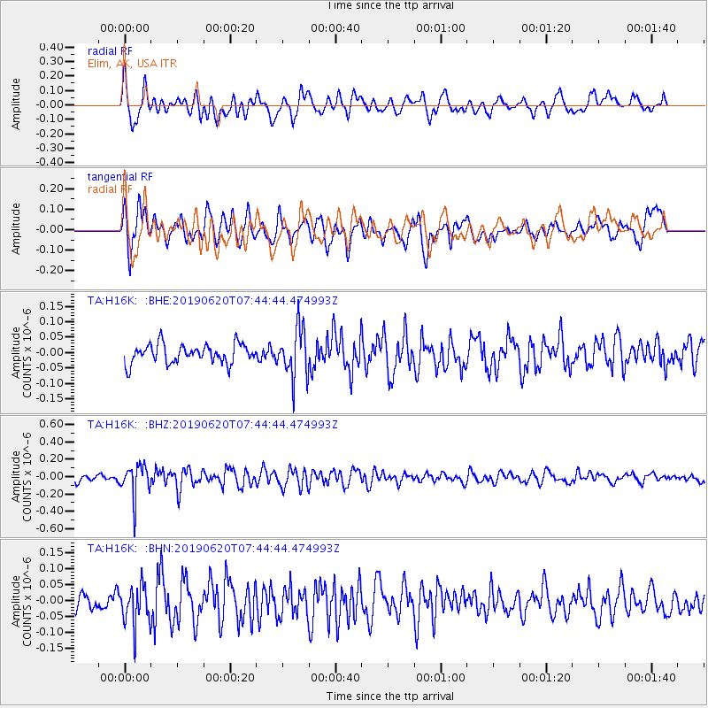
H16K Elim, AK, USA - Earthquake Result Viewer
*The percent match for this event was below the threshold and hence no stack was calculated.
| Earthquake location: |
Tonga Islands |
| Earthquake latitude/longitude: |
-17.7/-173.7 |
| Earthquake time(UTC): |
2019/06/20 (171) 07:32:57 GMT |
| Earthquake Depth: |
42 km |
| Earthquake Magnitude: |
5.6 mb |
| Earthquake Catalog/Contributor: |
NEIC PDE/us |
|
| Network: |
TA USArray Transportable Network (new EarthScope stations) |
| Station: |
H16K Elim, AK, USA |
| Lat/Lon: |
64.64 N/162.24 W |
| Elevation: |
216 m |
|
| Distance: |
82.5 deg |
| Az: |
4.958 deg |
| Baz: |
191.031 deg |
| Ray Param: |
$rayparam |
*The percent match for this event was below the threshold and hence was not used in the summary stack. |
|
| Radial Match: |
71.45762 % |
| Radial Bump: |
400 |
| Transverse Match: |
56.2867 % |
| Transverse Bump: |
400 |
| SOD ConfigId: |
18369291 |
| Insert Time: |
2019-07-04 07:39:40.940 +0000 |
| GWidth: |
2.5 |
| Max Bumps: |
400 |
| Tol: |
0.001 |
|
Signal To Noise
| Channel | StoN | STA | LTA |
| TA:H16K: :BHZ:20190620T07:44:44.474993Z | 3.7927327 | 1.8641316E-7 | 4.9150092E-8 |
| TA:H16K: :BHN:20190620T07:44:44.474993Z | 2.5070045 | 6.188464E-8 | 2.4684695E-8 |
| TA:H16K: :BHE:20190620T07:44:44.474993Z | 2.6352596 | 8.116124E-8 | 3.0798194E-8 |
| Arrivals |
| Ps | |
| PpPs | |
| PsPs/PpSs | |


