C23A Lambert, MT, USA - Earthquake Result Viewer
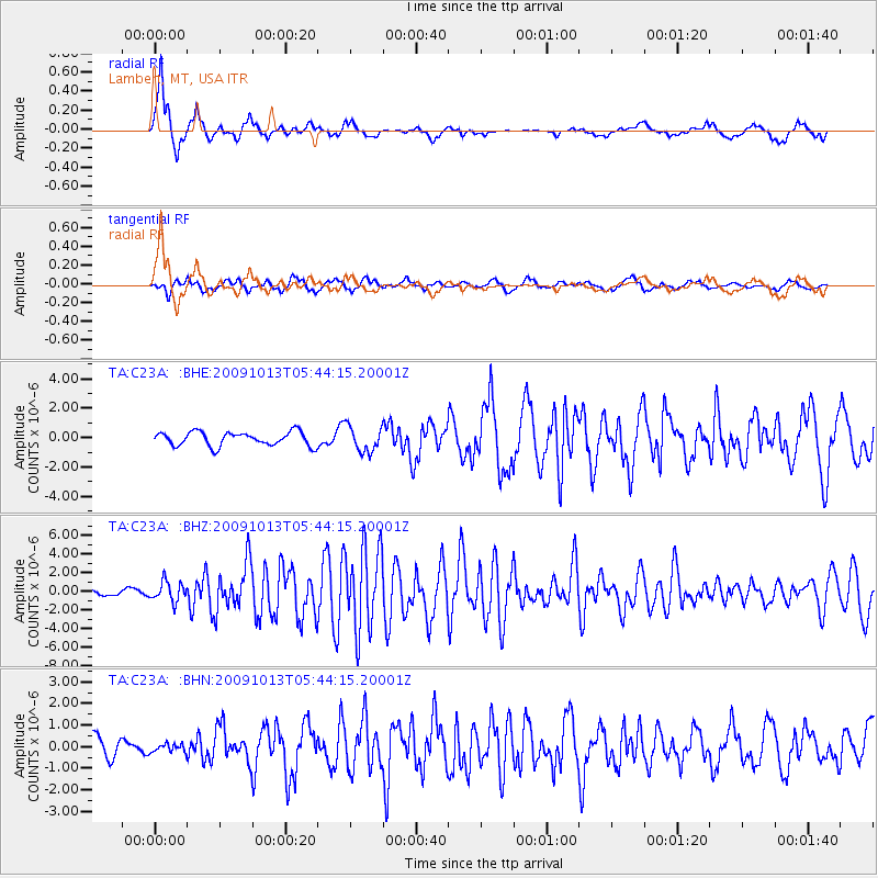
Earthquake location: Fox Islands, Aleutian Islands
Earthquake latitude/longitude: 52.8/-167.0
Earthquake time(UTC): 2009/10/13 (286) 05:37:23 GMT
Earthquake Depth: 24 km
Earthquake Magnitude: 6.0 MB, 6.1 MS, 6.5 MW, 6.5 MW
Earthquake Catalog/Contributor: WHDF/NEIC
Network: TA USArray Transportable Network (new EarthScope stations)
Station: C23A Lambert, MT, USA
Lat/Lon: 47.80 N/105.18 W
Elevation: 729 m
Distance: 38.7 deg
Az: 71.74 deg
Baz: 301.109 deg
Ray Param: 0.07535328
Estimated Moho Depth: 16.5 km
Estimated Crust Vp/Vs: 1.76
Assumed Crust Vp: 6.438 km/s
Estimated Crust Vs: 3.658 km/s
Estimated Crust Poisson's Ratio: 0.26
Radial Match: 91.38137 %
Radial Bump: 356
Transverse Match: 56.547348 %
Transverse Bump: 391
SOD ConfigId: 2622
Insert Time: 2010-03-07 00:15:53.697 +0000
GWidth: 2.5
Max Bumps: 400
Tol: 0.001

Signal To Noise

ChannelStoNSTALTA
TA:C23A: :BHZ:20091013T05:44:15.20001Z4.57401471.0333981E-62.2592803E-7
TA:C23A: :BHN:20091013T05:44:15.20001Z0.21473011.9056677E-78.874712E-7
TA:C23A: :BHE:20091013T05:44:15.20001Z1.84357988.741466E-74.741572E-7
Arrivals
Ps2.1 SECOND
PpPs6.6 SECOND
PsPs/PpSs8.7 SECOND