You are here: Home > Network List > TA - USArray Transportable Network (new EarthScope stations) Stations List
> Station O18K Koktuh Hills, AK, USA > Earthquake Result Viewer
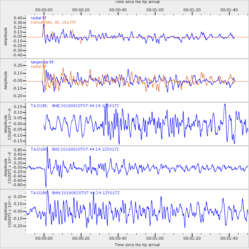
O18K Koktuh Hills, AK, USA - Earthquake Result Viewer
*The percent match for this event was below the threshold and hence no stack was calculated.
| Earthquake location: |
Tonga Islands |
| Earthquake latitude/longitude: |
-17.7/-173.7 |
| Earthquake time(UTC): |
2019/06/20 (171) 07:32:57 GMT |
| Earthquake Depth: |
42 km |
| Earthquake Magnitude: |
5.6 mb |
| Earthquake Catalog/Contributor: |
NEIC PDE/us |
|
| Network: |
TA USArray Transportable Network (new EarthScope stations) |
| Station: |
O18K Koktuh Hills, AK, USA |
| Lat/Lon: |
59.85 N/155.21 W |
| Elevation: |
544 m |
|
| Distance: |
78.7 deg |
| Az: |
9.403 deg |
| Baz: |
197.977 deg |
| Ray Param: |
$rayparam |
*The percent match for this event was below the threshold and hence was not used in the summary stack. |
|
| Radial Match: |
67.36469 % |
| Radial Bump: |
400 |
| Transverse Match: |
65.21599 % |
| Transverse Bump: |
400 |
| SOD ConfigId: |
18369291 |
| Insert Time: |
2019-07-04 07:40:19.211 +0000 |
| GWidth: |
2.5 |
| Max Bumps: |
400 |
| Tol: |
0.001 |
|
Signal To Noise
| Channel | StoN | STA | LTA |
| TA:O18K: :BHZ:20190620T07:44:24.125017Z | 5.783919 | 3.7472807E-7 | 6.478792E-8 |
| TA:O18K: :BHN:20190620T07:44:24.125017Z | 2.5799086 | 1.248323E-7 | 4.838633E-8 |
| TA:O18K: :BHE:20190620T07:44:24.125017Z | 1.4247408 | 7.193885E-8 | 5.0492588E-8 |
| Arrivals |
| Ps | |
| PpPs | |
| PsPs/PpSs | |


