You are here: Home > Network List > US - United States National Seismic Network Stations List
> Station CBKS Cedar Bluff, Kansas, USA > Earthquake Result Viewer
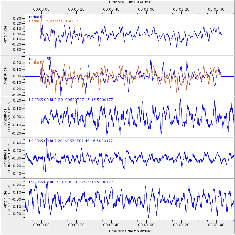
CBKS Cedar Bluff, Kansas, USA - Earthquake Result Viewer
*The percent match for this event was below the threshold and hence no stack was calculated.
| Earthquake location: |
Tonga Islands |
| Earthquake latitude/longitude: |
-17.7/-173.7 |
| Earthquake time(UTC): |
2019/06/20 (171) 07:32:57 GMT |
| Earthquake Depth: |
42 km |
| Earthquake Magnitude: |
5.6 mb |
| Earthquake Catalog/Contributor: |
NEIC PDE/us |
|
| Network: |
US United States National Seismic Network |
| Station: |
CBKS Cedar Bluff, Kansas, USA |
| Lat/Lon: |
38.81 N/99.74 W |
| Elevation: |
677 m |
|
| Distance: |
89.0 deg |
| Az: |
48.677 deg |
| Baz: |
246.429 deg |
| Ray Param: |
$rayparam |
*The percent match for this event was below the threshold and hence was not used in the summary stack. |
|
| Radial Match: |
56.78831 % |
| Radial Bump: |
400 |
| Transverse Match: |
47.59799 % |
| Transverse Bump: |
400 |
| SOD ConfigId: |
18369291 |
| Insert Time: |
2019-07-04 07:41:24.819 +0000 |
| GWidth: |
2.5 |
| Max Bumps: |
400 |
| Tol: |
0.001 |
|
Signal To Noise
| Channel | StoN | STA | LTA |
| US:CBKS:00:BHZ:20190620T07:45:16.500017Z | 2.532133 | 1.6868452E-7 | 6.661756E-8 |
| US:CBKS:00:BH1:20190620T07:45:16.500017Z | 1.453332 | 1.16026975E-7 | 7.983515E-8 |
| US:CBKS:00:BH2:20190620T07:45:16.500017Z | 1.4735632 | 8.463337E-8 | 5.7434505E-8 |
| Arrivals |
| Ps | |
| PpPs | |
| PsPs/PpSs | |


