You are here: Home > Network List > US - United States National Seismic Network Stations List
> Station MSO Missoula, Montana, USA > Earthquake Result Viewer
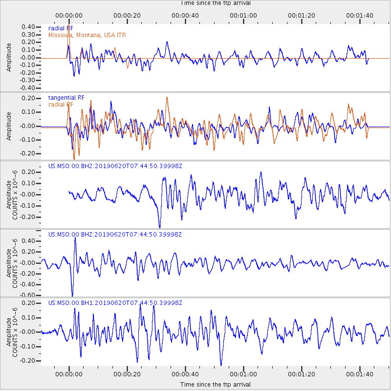
MSO Missoula, Montana, USA - Earthquake Result Viewer
*The percent match for this event was below the threshold and hence no stack was calculated.
| Earthquake location: |
Tonga Islands |
| Earthquake latitude/longitude: |
-17.7/-173.7 |
| Earthquake time(UTC): |
2019/06/20 (171) 07:32:57 GMT |
| Earthquake Depth: |
42 km |
| Earthquake Magnitude: |
5.6 mb |
| Earthquake Catalog/Contributor: |
NEIC PDE/us |
|
| Network: |
US United States National Seismic Network |
| Station: |
MSO Missoula, Montana, USA |
| Lat/Lon: |
46.83 N/113.94 W |
| Elevation: |
1264 m |
|
| Distance: |
83.7 deg |
| Az: |
36.649 deg |
| Baz: |
235.986 deg |
| Ray Param: |
$rayparam |
*The percent match for this event was below the threshold and hence was not used in the summary stack. |
|
| Radial Match: |
66.079346 % |
| Radial Bump: |
400 |
| Transverse Match: |
52.536976 % |
| Transverse Bump: |
400 |
| SOD ConfigId: |
18369291 |
| Insert Time: |
2019-07-04 07:41:32.372 +0000 |
| GWidth: |
2.5 |
| Max Bumps: |
400 |
| Tol: |
0.001 |
|
Signal To Noise
| Channel | StoN | STA | LTA |
| US:MSO:00:BHZ:20190620T07:44:50.39998Z | 3.1458142 | 2.403961E-7 | 7.641777E-8 |
| US:MSO:00:BH1:20190620T07:44:50.39998Z | 1.2828057 | 7.707532E-8 | 6.00834E-8 |
| US:MSO:00:BH2:20190620T07:44:50.39998Z | 3.7449074 | 1.3750288E-7 | 3.67173E-8 |
| Arrivals |
| Ps | |
| PpPs | |
| PsPs/PpSs | |


